
Carmacks – Five Fingers – Minto
| Start time: | 05:03:00 |
| Altitude: | 586.7 metres ASL |
| Time Stopped: | 6 hrs 46 mins |
We woke to the alarms we’d set on our watches at the start of day two. We’d set redundant alarms in case one didn’t go off, or we turned them off without waking up. Somehow we managed to burn 45 minutes more than we expected getting underway. Breakfast prep was simple. Boil water. Add water to porridge in mylar bags. Pack away the gravity water filter we’d left running overnight. Stuff sleeping bags. Take down the tent. Shove everything back into the boat. We’d allowed 30 minutes, but had taken 75. Basically a lack of hustle.
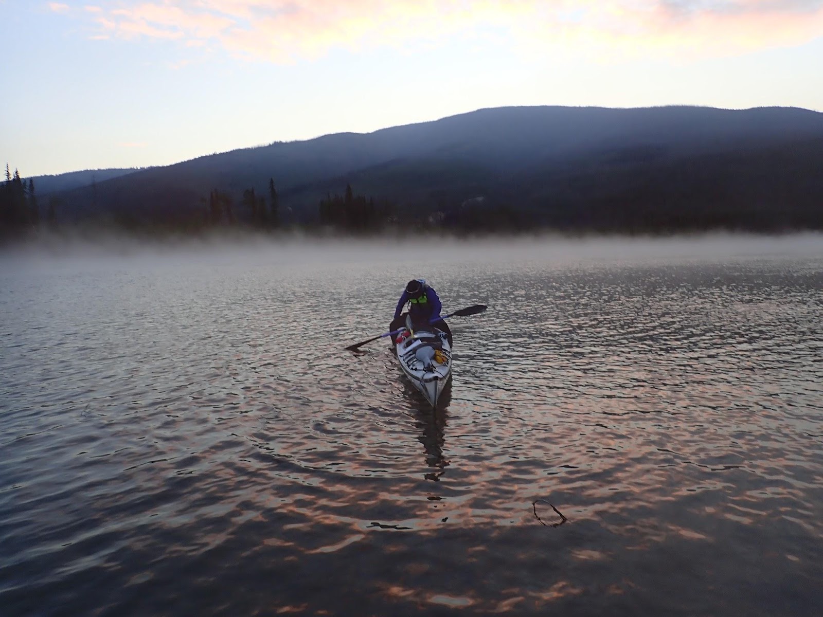
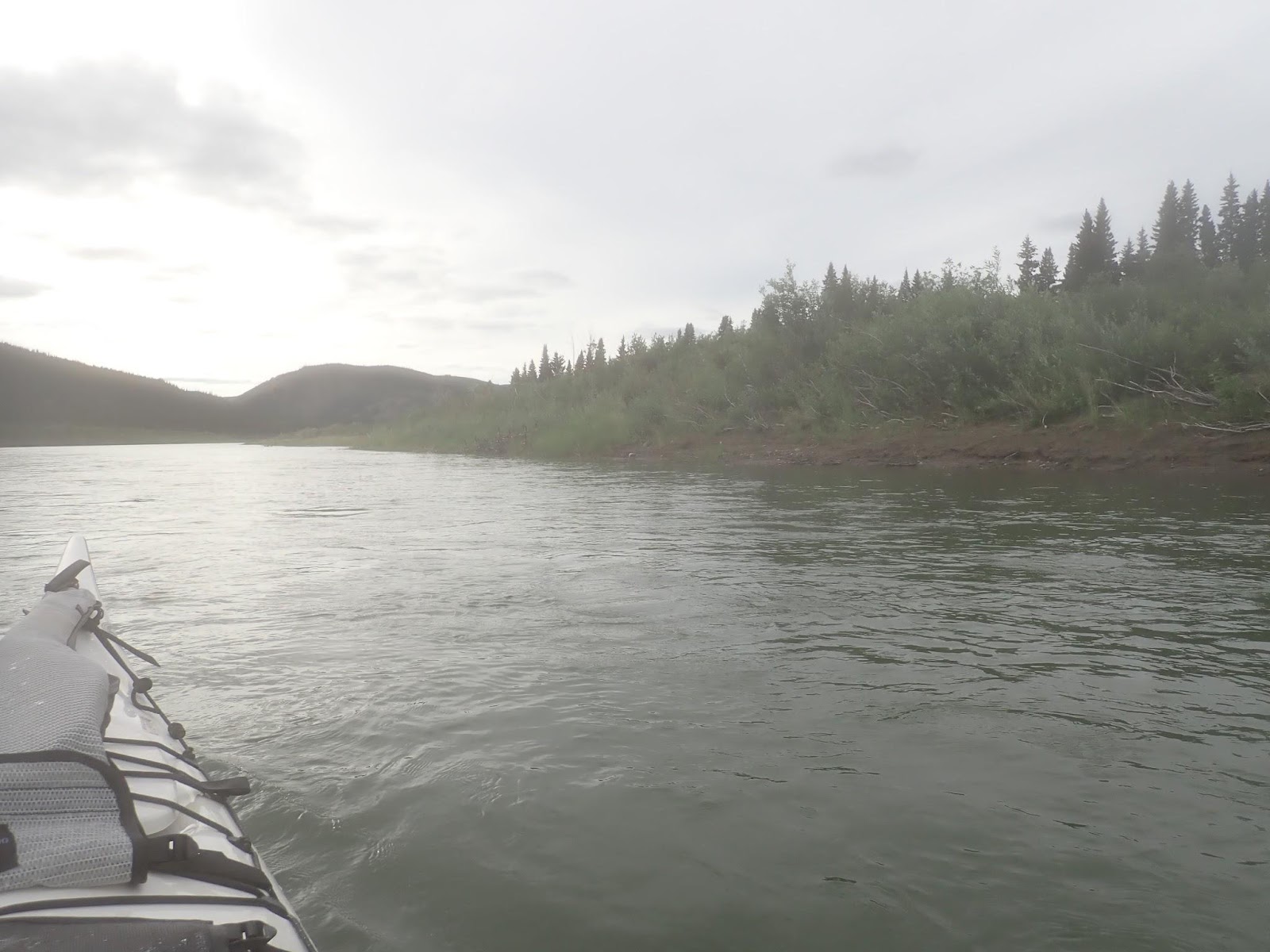
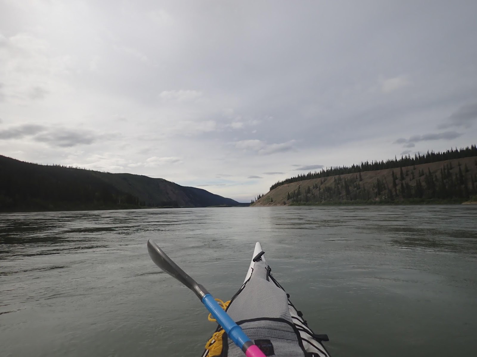
Underway again, with a light mist hanging over the water, we felt good. Muscles not too sore from the previous day. Mentally OK after a fairly decent sleep.
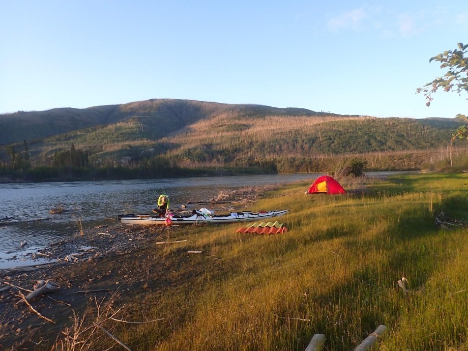
The previous year, our first night had been much worse. Pushing to the end of the stopping period, we’d drawn a short straw on the last available beach, which was a wet silty mud bank inches above water level. The only positive was that the silt made it easy to see the fresh bear tracks. That prompted us to halt our unpacking, get back in the boat and move 500 metres further downriver. The second site had been drier, but the thought of bears in the area had us sleeping fitfully all night. That wasn’t helped by noises from the 200 metre high gravel bank on the opposite riverbank which was being slowly undercut by the river. All through the night we’d wake to the sound of a stone bouncing down the bank.
This time we simply slept1.
Day two would take us past the settlement at Carmacks, and on to the two notable rapids on the river, Five Fingers and Rink. With those milestones out of the way, we’d aim to get as far down the river as we could, aiming for somewhere past Minto, and as close to Fort Selkirk as we could manage.
The meandering approach to Carmacks is perhaps the section of river I find the most frustrating. The river turns back on itself repeatedly, and you’re often paddling north or south when you want to be progressing west. Early in the day, we passed through some of the areas that had burned by wildfires. Now mostly extinct, there were still some spots where smoke rose from naked trunks or smouldering stumps.
A 30ft tree with its branches slowly burning collapsed into the river just ahead of us as its base finally succumbed to combustion from within. We made a mental note to stay away from the river banks.
The trouble with these winding stretches of river is that you have nothing but trees and water to look at, and plenty of time to think. As the river wanders, so does your mind, until it finds something that needs its attention. On the morning of day two, what needed my attention was the increasing ache in my backside. Despite the gel seat pads, 20 hours of cumulative time in boat was causing a dull pain from deep in my hips. Every 20 minutes or so, I was leaning against the back of the cockpit to lift my ass out of the seat and let some blood flow back. It was early on day two I was in for a tough week if I couldn’t find a solution.
One of our race strategies is to simply stay in the boat. If you stay in the boat, the river is carrying you forward even if you’re not actively paddling. You can eat in the boat, pee in the boat, and if you’re tired enough, sleep in the boat, as long as you’re not steering. We’ve agreed to draw the line at pooing in the boat. For that we stop, but otherwise you stay in the seat and the boat keeps moving down river.
We were about an hour out of Carmacks before I reached the realisation that I could fix my problem by adjusting my footrests.
Magic!
It’s amazing how much difference half an inch can make. With my feet further forward, my knees came down and the seat pressure moved from the back of my pelvis to the larger area on the back of my thighs. Immediately I felt more comfortable in the boat. I could drop my knees to the floor for an easy cruise, or lift them up for a strong driving stroke. The ability to shift positions and get the blood flowing occasionally meant I could now go all day.
Unfortunately some damage had been done and I’d still be feeling the ache of the first 275kms on the 15 hour flight back to Sydney two weeks later. A good reminder to deal with discomfort early.
Deal with issues when they arise: Don’t wait to deal with problems. Stop and fix them at the first opportunity. If it rubs at the start of the day it will probably be bleeding by the end. If nothing else, the lack of mental stimulus will cause you to give too much attention to your aches or strains and they’ll be amplified. Stop and fix it. Avoid if possible. If you can’t avoid it, fix it while it’s still minor. If it’s not minor, stop it getting worse.
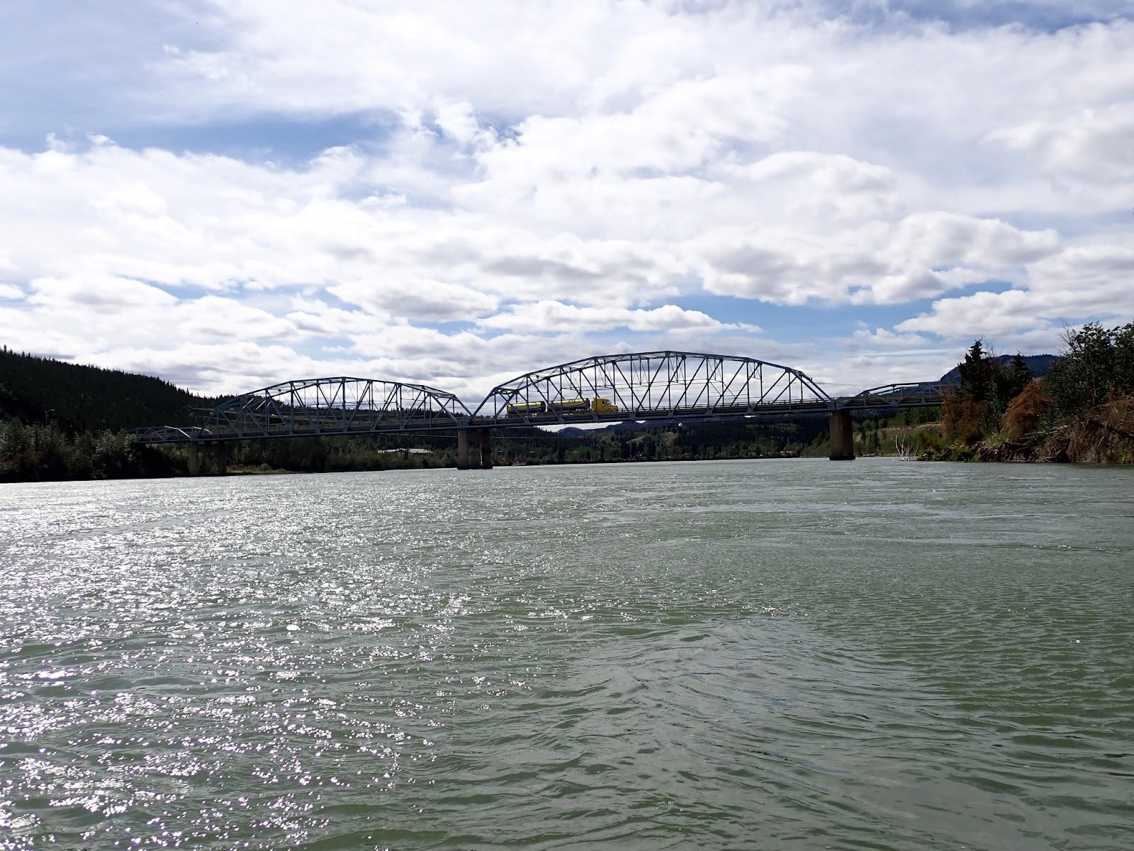
In my mental map2 of day two, the Yukon river runs west to Carmack and then Five Fingers rapid is just around the corner. When we reached Carmacks in the early afternoon, we were still a good 35km of paddling from Five Fingers.
After Carmacks, against all expectations, we started coming up on other teams. It’s slow business catching other boats, even when you’re moving faster. From the first sighting, the gain is almost imperceptible, closing faster as you get closer and it becomes easier to judge distance across the water. Close-in the speed difference is easy to see, but it fades again as you pull further ahead.
We passed two boats in the first hour after Carmacks. We seemed to be moving faster, but a couple of times the other boats put in a burst to stay ahead of us. We continued to run our shortest path route which often put sand bars and islands between our boat and the others. We mostly seemed to be making the right choices. When we made poorer choices, we had enough oomph to compensate. Where the islands obscured us from view, we gave the pace a bit of a nudge to make sure we had a break when we emerged.
We weren’t racing, but any two boats on the water is a race.
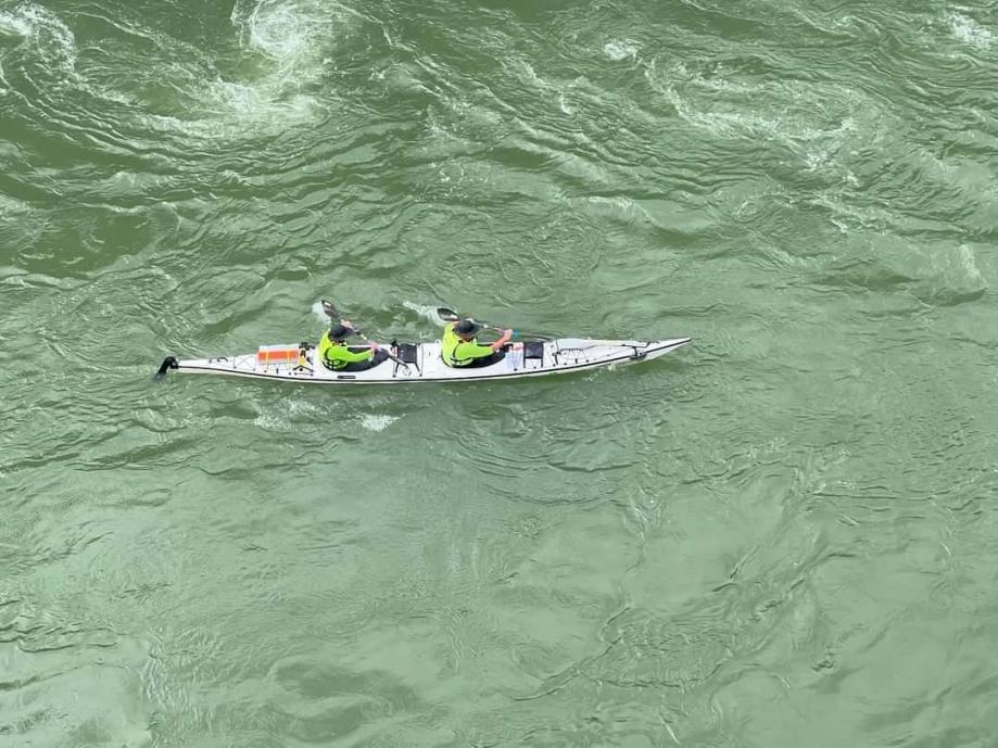
There were two boats visible in front of us as we approached Five Fingers. They both went right and wide around the outside bend that leads into the approach. It’s the prescribed line.
Five Fingers is a river-wide ledge-drop of a few metres at a point where the river flows through a line of rock pillars – the fingers. The safe line is the right-most channel which is about 40 metres wide. Around 20% of the river goes through it. The water accelerates down the drop like a ramp, boils at the sides a little as the channel narrows and then forms waves as the fast moving water stacks into the back of the slowed water at the exit. The journey through Five fingers lasts about 20 seconds, door to door.
All I know for certain about the left side of Five Fingers is that racers in both the YRQ and Y1000 are told to avoid it. There’s talk of dangerous rocks and vicious currents. I’ve read that the remains of a sunken paddle steamer lie at the bottom of the drop, a hazard to any boaters unwary enough to take the wrong line. The idea that a paddle steamer sank there is intriguing. It points to a time when paddle steamers travelled through Five Fingers in both directions, carrying their cargo to river communities. How bad can the left hand side be if cargo boats used to use it…?
It was probably a mistake to voice that thought out loud to Kate as we made a fairly acute approach across the mouth of the left hand channel, just skipping beyond the reach of the current that would drag us in and over the drop. It can at times be hard to hear what your partner is saying when you’re separated by 8 feet and surrounded by the roar of a rapid. Not so in this case. No. Unambiguous. Not open to negotiation.
We got close enough to see quite a lot of the rapid at the base of the drop and didn’t see anything that would have prevented us from taking a line down that side. Whether it’s a viable line remains a question to be answered another day.
Our direct line across the top of the drop brought us to the entry of the right-hand channel at the same time as the other two boats arrived on their longer approach line. So much so that the obvious intercept course was to slot into the 50 mere gap separating them.
We’d spotted Jon on the lookout high above the rapid, and there was a moment where I thought he might think buzzing between the two boats was a little aggressive, but then the second boat caught the edge of an eddy and speared off in the direction of the cliff while the crew frantically tried to correct with the rudder.
I refer back to my thoughts on the World Kayaks 640 and it’s rudder system in an earlier post.
Things were happening fast here.
The lead boat entered the drop and got pushed left out of the current, into the boils. We followed down the drop pointing slightly right to compensate for the side currents, roller-coastered over a couple of waves and continued straight to the end of the wave train.
Hopefully Jon had been videoing the boats coming through. It’s always good to look back on a photo and think “wow! We looked good going through there” even if you were broken and exhausted before and after. For some reason photos seem to shape memories more firmly than remembered experiences.
Clear of the rapid, we paused for a minute to eat and drink. The following boat with the two kiwis came alongside as we resumed paddling. I made a small apology for barging through and offered some advice. “A rudder only works when you’re moving faster than the water”3. They’d stopped paddling when they’d spiralled in towards the cliff and had then tried to steer out again with their rudder dead-stick in the current.
When I was learning to paddle, the first advice I can remember was always keep paddling, or more colloquially “Road-kill possums all have one thing in common… they stopped”.
By the time we passed through Rink Rapid, 10 kilometres further downriver we had shaken off all but one of the boats we’d seen coming out of Carmacks, but another had popped out of a side channel unexpectedly just after Five Fingers.
Rink doesn’t garner the same of attention as Five Fingers, to be honest, I can remember paddling through it in the 2019 YRQ and haven’t been able to find it since then, probably because of the lower water levels.
From Rink Rapid to McCabes Crossing, the river weaves along as a couple of channels. In my mental map, the left side is narrower, and shallower than the right, but also offers a more direct line if you can string the various channels together properly. The two sides also run a different gradients, The right descends early and the left stays high, separated by a string of gravel bars. If you pick the right crossover point, you get a little turbo boost as you drop into the lower channel on the right. Leave it too late and you run out of water.
We seemed to choose our line quite well.
Approaching Minto (385km) and our target for day 2, we could see smoke in the distance. Probably the fires that had been burning near Fort Selkirk. We had enough time before the 11pm stop time to cover the next 45km to Fort Selkirk, but the visible smoke was a concern.
We knew there was an active fire around Selkirk and that we didn’t want to be camping too close to that. My susceptibility to smoke was the first concern. While I had an effective smoke mask, I really didn’t want to have to sleep in it for the night. More pragmatically, after talking to YRQ paddlers who had scorched holes in their clothing from wind blown embers a few weeks earlier, we didn’t want to pitch our tent and wake up to find it full of holes.
We’d annotated our maps with locations of recognised campsites, using the Rourkes River Guides. Mostly they had been useless adornments to the map, being nowhere near the areas where we would be each night, already occupied, or so well used that there was a higher risk of bears than a random sandbar. What they did provide though was a general sense of which areas had low flat river banks. If you could see a series of clustered camps, the whole stretch was likely OK. If there were no campsites for a long stretch, the banks were likely high and flat ground scarce.
High banks and no campsites pretty much sums up the 30km leading into Fort Selkirk.
The last of the marked campsites had just disappeared behind us when the Gods of Fire entered the debate. We’d been looking at a general pall of smoke about 30km ahead, which seemed consistent with where we thought Fort Selkirk was. Another larger smoke plume was rising to the north of the river, maybe 40km out and blowing East beyond the point where we expected to turn West. It wasn’t concerning us.
What did get our attention was the sudden appearance of a new column of smoke rising like an atomic mushroom from a ridgeline about 20km ahead. Based on the time of day(night?)5 and our pace downriver, we would be expecting to halt for the night within a kilometre or two of that new outbreak. Although we couldn’t see the flames directly, there was a glow in the lower plume and from the plumes size and sudden rise, this had all the hallmarks of a fire that had found fresh fuel, maybe a valley or a previously protected stand of trees on a hillside. Either way, with the wind picking up, it was an easy decision6 that we didn’t want to be near enough to it for a windshift to bring us into the smoke or ember zone while we slept.
We’d covered the required distance for our race plan. Even if we could get far enough past this new fire before our mandatory stop, with fires at Selkirk, Coffee Creek and White River, we couldn’t expect clear air for another 150km. The right decision was to pull up early.
Tomorrow would be smoke day.
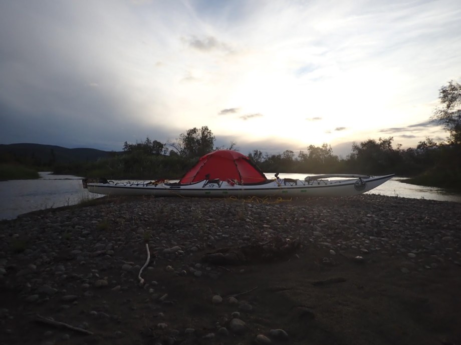
Because we’d taken an extra 30 minutes to make our decision, we’d passed the area of campsites we annotated on our maps. The river had consolidated into a fast moving main channel which had stripped the occasional islands of low beaches and the higher banks were strewn with branches or overgrown with bushes. Our best option, which was disappearing fast, was in the series of small channels along the western bank. The slower water would likely offer sandbars and the islands would give us some shelter from the wind. At the same time, there was the very real possibility that we were leaving the main channel and entering a maze that would end in log jams or simply run dry.
I’m sure the team in the white and blue boat who had been duelling with us for the preceding hour must have thought we had a screw loose when we turned left off the main channel and disappeared into a gap in the bushes.
We quickly came to a low sandbar which was dry enough to pitch the tent on and shaped in a way that we could pull the boat up beside us. The wind was starting to howl. We were protected by trees on all four sides and still felt compelled to tie the tent to the boat. Our day two campsite was never going to appear in a travel brochure, but it was good enough for us.
Drifting off to sleep, I briefly wondered what the dot-watchers who were following our tracker online would think of our odd behaviour7.
It’s an interesting thing to consider the track we were recording. From year to year, the tracks of racers have been jealously guarded, but why? Our track for the last few hours of day two would have shown us dodging from side to side on the river as we’d scouted for campsites, and then we’d gone completely off track to find a spot out of the wind. The planned track and the actual track end up being two very different things. Anybody who religiously followed our 2024 track in a subsequent year would wonder what on earth we’d been dodging8.
By this stage, we had lost track of where we were placed in the race. Some teams had passed us during the night and while we’d been faffing around in the morning. We’d passed some teams during the day. With our early stop, we’d almost certainly lose some ground to teams prepared to continue on towards Fort Selkirk.
| Stop time: | 21:38:15 |
| Moving time: | 16:35:15 |
| Distance: | 219.7 km (136.5 mi) |
| Average speed: | 13.2 kph |
| Campsite: | 62° 36′ 52.3″ N, 136° 58′ 44.32″ W (past Minto but short of the fires) |
| Race Position: | 11th |
| Distance Completed: | 238 mi |
Help encourage more posts by buying Steve a coffee…
Choose a small medium or large coffee (Stripe takes 10% and 1% goes to carbon reduction)
Or enter a custom amount
Your contribution is appreciated.
Donate- Sleep is always hard on the first few nights. It gets easier ↩︎
- When you look at the mapping, Notice how the longitude lines converge towards the North Pole. Very odd for racers from the mid southern latitudes of Australia ↩︎
- If in doubt, keep paddling. It stabilises the boat and keeps the rudder engaged. In situations where paddling forward means approaching a hazard faster, paddle upstream, which gives you time to think while still giving you steering ↩︎
- Always make sure you look good for the photographer. When the blisters have healed and the pain is forgotten, you’ll be able to look at the photos and delude yourself that you were better than you really were. Or, in the words of Mike Dey “Photographer! Shut up! Sit Up! Sync Up!” ↩︎
- concepts of day and night lose their meaning north of Carmacks because it no longer gets dark. Henceforth in my narrative, day is when we are awake and night is when we are sleeping. ↩︎
- See previous tip to set your risk red lines before the race. We’d pre-agreed that we would not be stopping within a bulls roar of a fire zone. ↩︎
- Reading Facebook comments after the race there was plenty of speculation about injuries or problems, because obviously, nobody could see the fire in front of us. ↩︎
- After the finish I shared the first part of our actual track with a friend planning to race the YRQ in 2025. Looking back at the track, I felt obligated to annotate it with comments like “ducked down the wrong side of this island to sneak past another boat”, “Only stopped here for a poo. No trees to hide behind. Not recommended unless you’re desperate” ↩︎

One thought on “2024 Yukon 1000 – Day 2 – Saturday”