
Mist – Twisters – The Flats – Madness – Fort Yukon
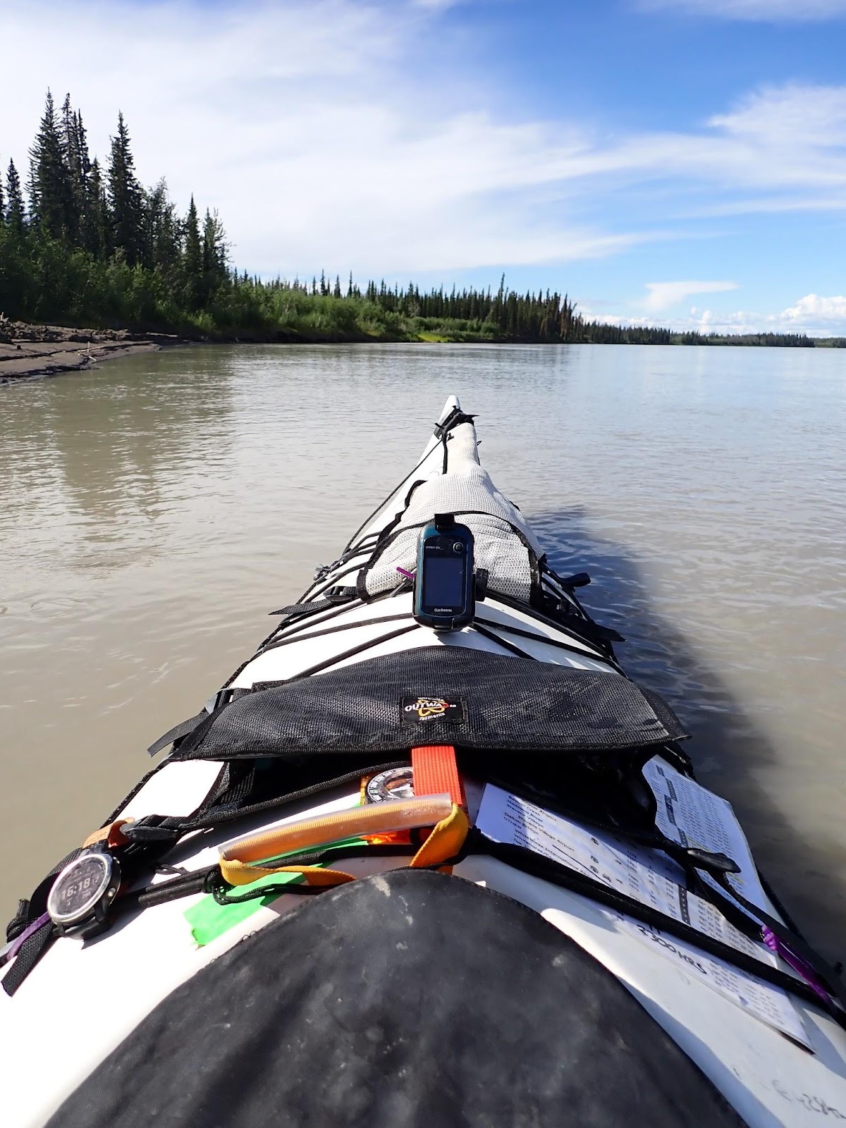
| Start time: | 4:25:00 |
| Altitude: | 209.7 metres |
| Time Stopped: | 6 hrs 24 min |
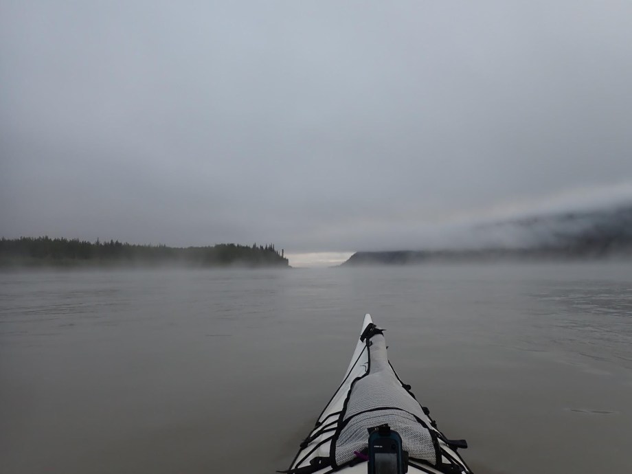
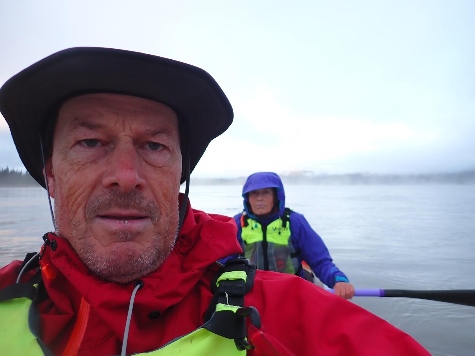
Waking to our alarms, we were back on the water with a little more hustle, only 24 minutes late this day. Urged on a little by the wet mist that hung over the water and cut visibility to 20 or 30 metres, but also a little sluggish at the idea of pulling on cold wet pants which had been drip drying on the top of the tent all night.
Looking back at the 1000 from afar, the worst part was pulling on wet pants in the morning. Ten times worse than anything else, as I would tell Jon at the finish line. And I think the marketing people who labelled the pants ‘Hydrophobic’ need to open a dictionary. The sodding things were sodden and sodding cold every sodding day.
Incidentally, hydrophobic seems to be a word Jon has trouble with. One of the items covered in the race safety briefing is the requirement for a warm jacket, but you are not allowed down. Even if to quote the race director, it’s “hydrochloric down”.
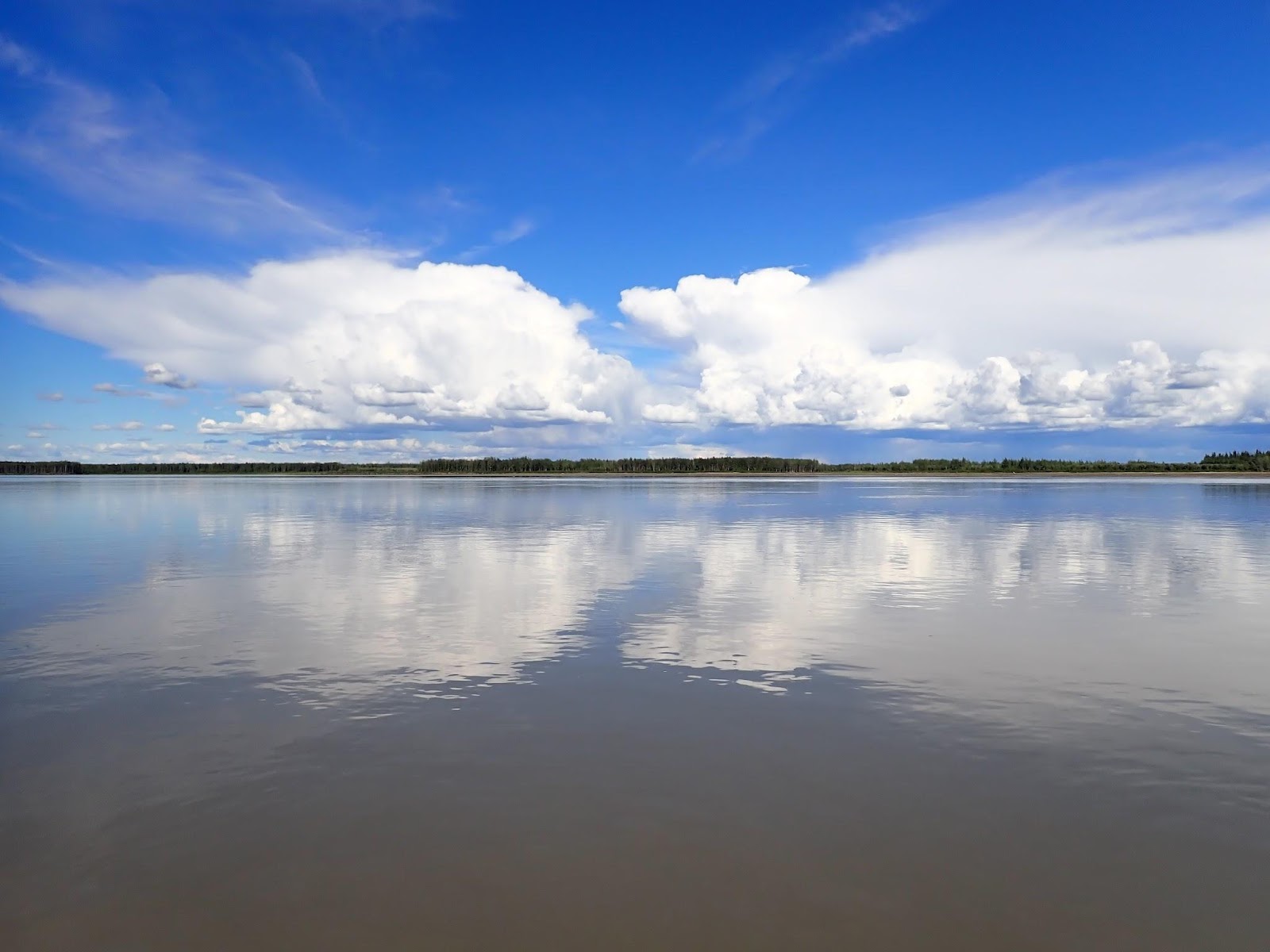
We set off into the impenetrable mist, unable to see where we were going, and entirely reliant on a combination of current, back bearing to the sand bar we’d just left, and our ever reliable GPS route. It was an hour before the mist lifted and we could see more than a few hundred metres ahead.
Slowly the riverside terrain was changing from high ranges to small hills. We’d soon be emerging into The Flats, a 130km stretch of river where topology and landmarks ceased to exist. The distant mountain ranges would be too distant to see, let alone use as navigation points.
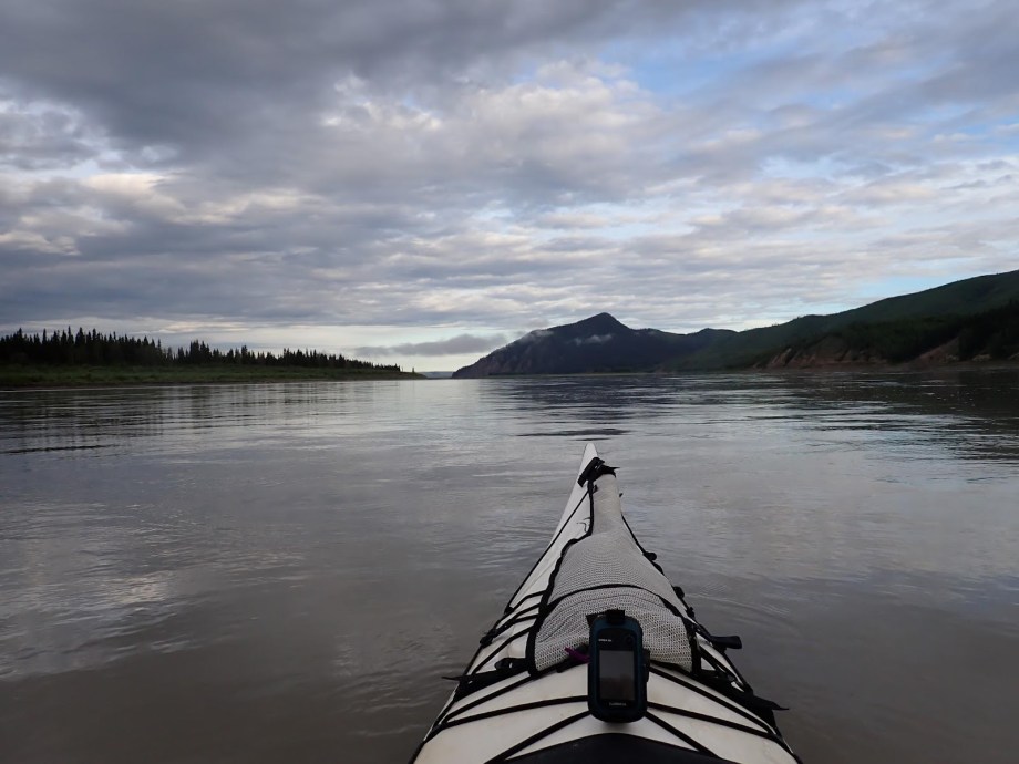
There would also be no shelter from the winds that Jon had warned us about in the safety briefings.
We were being lashed by one of those winds when we transited the last narrow point on the river before Circle1. From the way the waves were whipping up and spray flying, we were head down into a 40 kph wind blasting through a narrow opening in the hills. We’ve spent the last two years paddling and training in Tasmania, which lies in the part of the Southern Ocean referred to by sailors as The Roaring 40s. We’re used to wind.
What we weren’t used to was water spouts2…
Ahead of us were two wispy towers of spray raising about 40 feet into the air. My first thought was that Twisters the sequel to Twister was opening in theatres and we were about to get a front row seat at the premiere.
The two spouts were meandering backwards and forwards across the narrow channel we needed to traverse. We sat for a few moments watching them before deciding that they were probably about the same intensity as an outback willy-willy3 so they probably couldn’t do much to a well loaded double kayak and two paddlers.
Thanks to a combination of good boat speed and precision steering, we never got to test that theory, slipping lightly through the gap between them as they were dancing towards opposite sides of the river.
Having survived trial by waterspout, we were on our way into The Flats.
Jon talks a lot about The Flats in the briefings. He spends a lot of time talking about the way the wind blows unobstructed across the plains and whips up waves on the wide river expanses from Circle to Beaver4. He spends somewhat less time discussing the navigational challenges of the area. He typically describes them as “challenging”5.
When Kate and I were about to have our first child, my father gave me some typically sardonic advice. “Nothing I can tell you will prepare you for what you are about to experience”.
I’m now going to try to describe The Flats, but nothing I can tell you will prepare you for the experience.
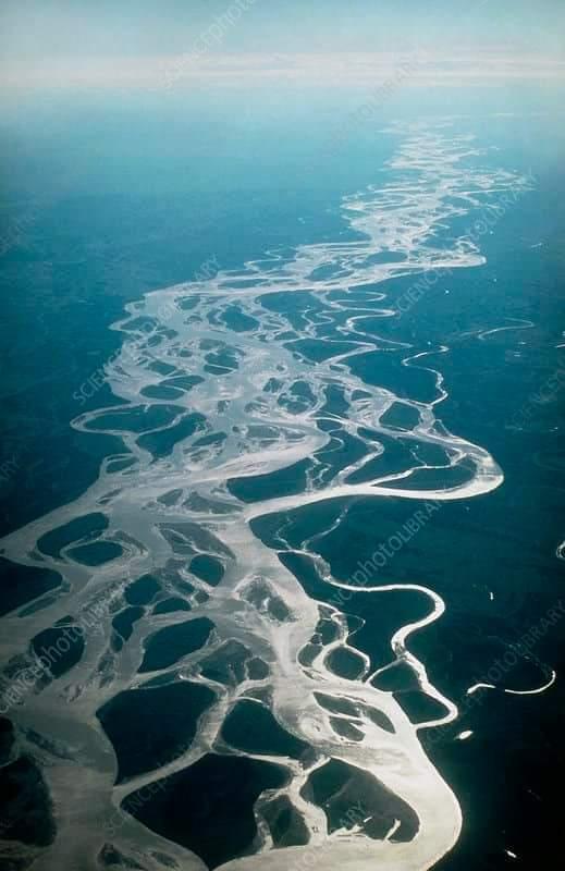
[I’ve included an aerial photo of the flats at the end of this post to help you understand the nature of the river, but stick with me for now]
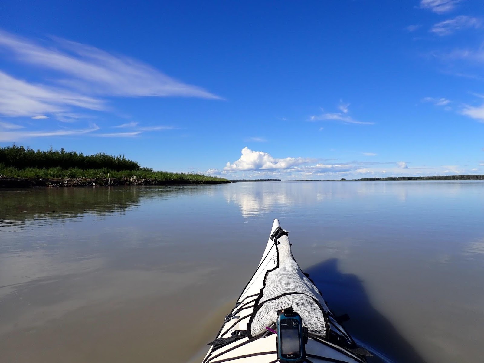
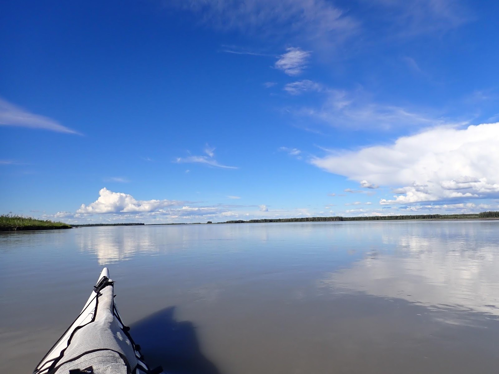
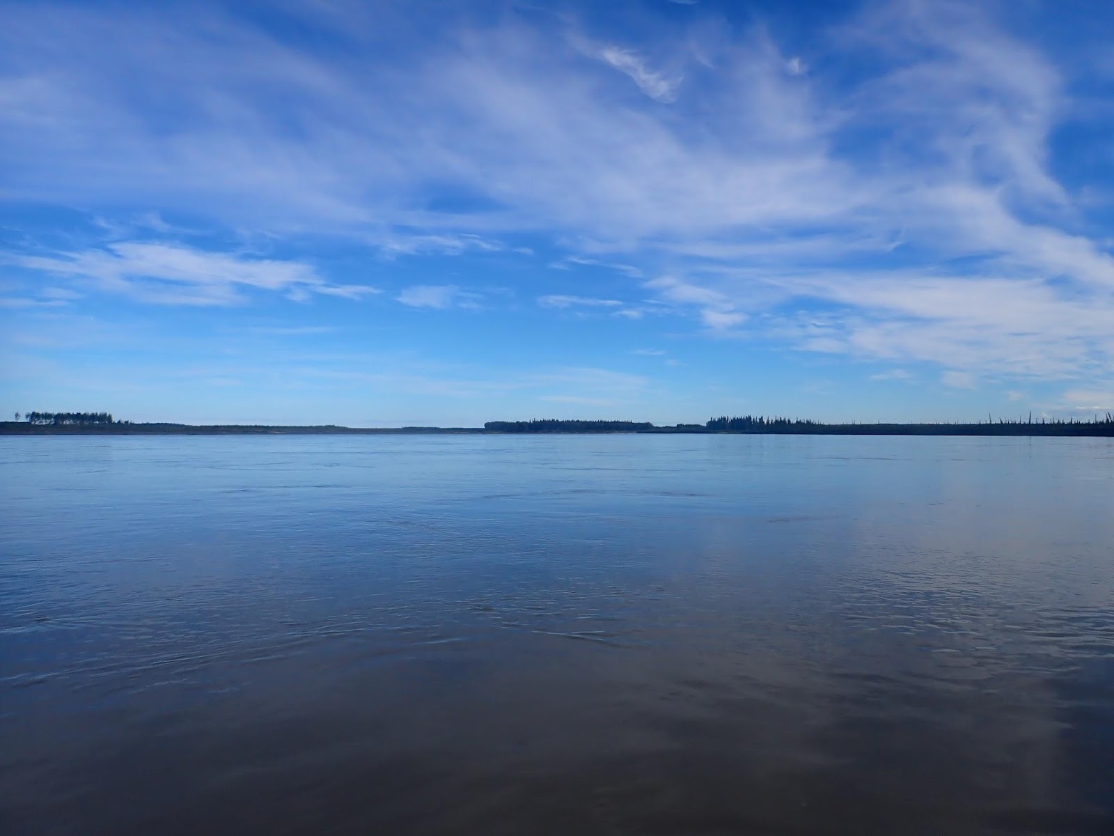
110km of low-lying gravel beds which are swept through by ice melt and floods on a yearly basis. Viewed on a map or through satellite imagery The Flats can look like the type of braided riverbed you would find in New Zealand – a ribbon of plaited streams endlessly crisscrossing through gravel bars formed by floodwaters. From the comfort of the kitchen table 10,000km away, it’s easy to imagine yourself navigating down the river, following the fastest channels from minute to minute as the river weaves in from of you.
But the scale is wrong.
The New Zealand rivers I learned to paddle on – The Waimakariri and Rangitata – were a few hundred metres wide at best and you can see all the options laid out in front of you and a bad decision can be corrected a few hundred metres downstream.
Through The Flats, the Yukon River is up to 10km across, the span made up of 5 to 10 meandering anabranches that could each be considered a large river in their own right. The low-lying gravel bars are often kilometres long and nearly as wide. Make a bad choice and you’ll be reaping the consequences for hours if you’re lucky.
A little like understanding the national debt, you think you understand it, but you really don’t6
Going into the 2023 event, we’d studied the maps enough to know how wide the river was in kilometers, but after withdrawing at Dawson, we hadn’t experienced The Flats from water level.
It’s even worse than that.
It’s flat. But that doesn’t mean you can see over the gravel bars and islands. The river cuts down into the gravel so even low lying gravel bars are above head height and obscuring your view. The islands which have survived successive years of flood and thaw rise as 6-10ft vertical cliffs of dirt, eroded and undercut at the base, covered by mature trees on top. They offer no sight lines and access to camping spots. Effectively you’re a rat in a maze.
It was possibly worse for us in 2024 because the river was low. The downside was the islands were less accessible, the upside was there were exposed gravel bars that offered level accessible campsites. We pondered as we paddled, what would the river look like if it was 6ft higher – campsites flooded, but still not high enough to make the islands accessible?
But wait, there’s more…
From the comfort of the kitchen table in Tasmania, we’d studied the river through satellite photos. There are big branches and little branches. The obvious approach was to plot a GPS track through the big branches and use the higher flows to go faster. Avoid the narrow channels and stay away from the branches at the extreme edges of the riverbed as they would regularly oxbow off into the hinterland for miles before rejoining the main flow(s).
“No plan survives first contact” – a quote trotted out by management consultants ad nauseum and often ascribed to Colin Powell or Norman Schwarzkopf in Desert Storm but originally uttered by the unfashionably Germanic Helmuth von Moltke before WWI.
We were well beyond first contact and while our plan was a little ragged around the edges after fires and battery issues, it wasn’t mortally wounded, until The Flats.
The place where I would erect the grave marker commemorating the final resting place of our navigation plan was somewhere deep in the middle of the flats. We were sitting in the middle of broad expanse of water, maybe 2 kms to the banks in every direction. We had entered from a large channel. We could see our exit path to the next channel across the expanse of water. We had an unobstructed view across open water.
We were exactly where our GPS track said we should be.
This was a change from earlier in the day when we’d been 100m off our course paddling through what the map insisted was an island, because following the course would have required paddling through an island that existed where the map said it didn’t7.
All of this is happening while your brain is addled by exhaustion, so you’re never sure whether the GPS is wrong or your brain is broken and you’re reading it incorrectly8.
The plan suggested we paddle with the dominant current to the channel entry a few kilometres ahead. But there was no current. There had been a current, which had ejected us into the expanse before evaporating like mist in the sunlight. We were becalmed, bereft of assisting current. A minor inconvenience compared to the realisation that our large expanse was in reality a very large shallow expanse of water. As the water had poured out of the channel, it had lost its speed, which had a twofold effect on the outpour. Firstly, the slower water had failed to scour a deep channel through the gravel bed. Secondly, the same slowing water deposited sediment waves along the already shallow bed.
About this point we were begining to doubt ourselves. We’d seen the Portuguese team printing some last minute satellite maps when we’d been in Whitehorse. Did they have access to a more recent version of the mapping than we’d used? Had we blundered into a giant maze of shallow ponds under prepared and over confident?
We were sitting in a shallow bowl, two kilometres wide in every direction, latticed with silt bars which were only inches below the surface.
The last time we’d had a challenge like this had been on the Murray River when we’d followed the river into the upper reaches of Lake Hume. The lake level had been so low that the water had only inches deep across the valley and the old sunken river snaked across the valley floor, invisible below the featureless surface. We’d navigated that by remembering that the New South Wales- Victoria border followed the left bank of the river so we’d paddled a course 20ft to the right of survey line mapped out in 1855.
This time there were no clues in the GPS.
The course we’d set while sitting at the kitchen table had us traversing this path by direct line. Probably 20 minutes paddling with the lack of current. It took the best part of an hour to weave a course along shallow but passable troughs scoured between shallow impassable bars that we could feel but not see thanks to the murky water10.
Two things worked in our favour. Firstly, there was no wind disturbing the waters surface, allowing us to see the tiniest of ripples caused by water that was only just moving. Two days later we’d be experiencing similar near surface gravel bars while the wind ripped 2ft waves over the surface, making them invisible.
Our second, unexpected bit of good luck was that “Tinky”11 has a long metal rudder that reaches 18 inches below the keel line. Conventional wisdom would suggest that a long rudder creates more drag so a racer would be best equipped with a short rudder. Indeed the stock boats of the Yukon 1000 were all fitted with very shallow rudders that minimised drag. They didn’t turn worth a damn, but they don’t drag.
Our long rudder was suddenly an asset, because it was an early warning system for when the water was getting shallower. If the rudder went “Ting!”, we were in less than 2ft of water. When it was peeling “Ting, ting, ting!”, it meant we were about to run out of depth for our paddles and were moments away from planting the hull on a silt bar.
The consequences of sliding up onto a silt bar needs some expansion. You’ve just slid onto a submerged mound of silt, because you had some speed on, you’ve slid up onto the bar so the boat is no longer suspended by water displacement. You’re now planted on silt. Like mud, but thinner. Thinner in that it doesn’t have much substance. Certainly not enough to hold the weight of somebody climbing out of the boat, standing up and pulling said boat, backwards out of the sucking ooze into which it is now embedded with Dyson-like suction. But you’re stuck, so reluctantly you climb out of the boat to discover how deep you’ll sink before your feet either reach underlying gravel, the viscosity of the silt overcomes your descent12
Most likely, you sink to your knees and only realise you lost your left shoe as you’re climbing back into the boat 20 feet from wherever you lost it.
Best to be avoided.
After spending an hour deciphering the sub-surface topology of the shallow pond, we finally made our escape into the outflow channel and began to reassess the merits of our widest channels navigation strategy13.
Our revised strategy was to follow the current. This was what Jon had suggested in the briefing and it isn’t completely without merit. I’d give it a 3/5 stars as a central tennent of a navigation plan for The Flats. Like our now discarded biggest channel strategy, it worked more than it didn’t. The difference was that it failed in different ways.
Where biggest channel sometimes dropped us into shallow expanses, follow-the-current had the potential to send you off into the countryside on a fast flowing but very long anabranch.
Occasionally, we’d catch a glimpse of what we thought was a flash of reflected sunlight from a paddle, or another team in a distant channel. Those that were ahead of us eventually resolved into trees or ripples on the water, but the glimpses from the extremes periphery of the river left us wondering whether we were in the wrong part of the river and losing ground to better prepared teams.
By mid afternoon, we’d reached a frustration point with the weaving and twisting river. The low Northern Hemisphere sun was sending the wrong directional signals to our brains and it began to feel like we were paddling from the extreme left bank to the extreme right and back again through twisted channels without making any significant downstream progress.
Later, looking at the GPS track, we hadn’t wandered laterally very much at all. We’d been weaving along the Western third of the channels. No more than a few km left or right of downstream. It just felt like 10kms. That’s how the scale of The Flats plays out.
The number of equally flowing channels was an added vexation. Imagine a maze where every path leads forward. There’s no apparent difference between the two channels to the left and the two channels to the right. What you can’t see is what happens next. How they end. Of two equal channels, one might flow unchanged to the next junction, while the other diverged into multiple smaller outflows, leaving us bashing the riverbed in a narrow gravel chute.
This was the point where we discovered that Tinky was possessed14.
The scruffy old Passat proudly wears three Yukon 1000 stickers. 2022, 2023, and ours from 2024. She’d seen Dalton Bridge twice already under the steerage of Salli O’Donnell in 2022 and Emily and Dan from 2023. She knows the way home.
If you lift your toes off the rudder pedals and let the boat glide forward, I swear to the Gods of the river, she turns towards the strongest outflow. Every time. It’s a miracle!
We started steering… by not steering.
The other thing we stopped doing was following our GPS with pre pre-programmed route.
We’d packed a compass in with the high resolution maps we’d said we’d never use15. We got the compass out. Lined it up on a bearing from Circle to Fort Yukon, which was 6 degrees. I tucked it under the bungee cords on the front deck and started paddling again.
The compass didn’t help to select our route, mostly it served as a confirmation that our overall progress was in the right general direction. We were still meandering 10-15 degrees either side of our bearing, but now with more confidence that we our overall direction was correct. It really helped to overcome the loss of natural direction caused by the low light, lack of landmarks on the horizon or whatever other cues were missing in the lowland expanse.
The problem you plan for isn’t a problem (any more): You’re going to encounter the unexpected. The more possible events you consider in your planning, the less you’ll be under pressure to improvise when you’re stupid from exhaustion. Over 1000 miles, the wide shallows on the flats were really the only thing16 we hadn’t considered in our preparation. Because we were well prepared, we had the headspace to deal with it.
The sun beat down and the hours wore on. Nearing Fort Yukon, the low islands started to consolidate, providing faster flows which were easier to discern, until they weren’t. Several times we followed the dominant flow between islands only to find it dispersing into stillness through a number of small exit streams.
At one point, we pulled into an eddy behind a fallen tree to check our position. I was fumbling with the detailed pages of the mapping when a submerged branch erupted to the surface making me grab for my paddle. One of my 6 double-sided map pages and the Sharpie I’d been making notes with splashed into the water and slipped beneath the surface – My copy of a third of the course had just gone to the bottom of the river. Thankfully Jon insists you carry two sets of maps. In this case, Kate was using the second set to follow progress from the back seat.
Frustration spilled over again about 40km short of Fort Yukon. We’d run into slow water and felt like we’d almost circled an island to return to the main channel which still wasn’t flowing. If it wasn’t for the compass confirming we were heading the right way, we would both have sworn we had circled an island to the point that were were paddling back upstream. Again we were finding that the biggest flow on the biggest channel wasn’t impervious to running into a backwater.
Like a gambler on a losing streak, I needed to break the chain of bad luck, so I did something reckless. Coming up on the left was a side channel that was draining water away from the river. On the map it lead into a long complicated meander that went for miles into the hinterlands before returning to the river an hour downstream. What I’d spotted though, was a sliver of blue that linked the entry and exit with a shortcut.
It was a 100 to 1 against. Take the fast flowing side channel and hope that the creek on the map actually held some water. If it was wet, we’d be on an express lane to the the downriver confluence. If it was dry, we’d be doing 30kms to advance 10. The best option would be to avoid the anabranch and the shortcut and just stay on the main river grinding out the miles on the slow current.
So many things could go wrong. The channel could be dry from the low water level. It could be choked with logs. it might not even exist after the snow melt had blown through.
We couldn’t see far enough into the side branch to know.
Sod it…
Hours on slow water had driven us mad with boredom. Maybe that’s why we made the turn. To take a risk. Roll the dice. Break the hoodoo. Light a fire in our flagging motivation.
The lift was almost instantaneous. On the narrow channel with the faster flow, the perception of speed returned. Following the channel on a long righthand bend, we drew closer to the bank and our cadence picked up as we were rewarded by the bank slipping quickly behind us on the right. We found the first cut. It wasn’t dry, but it also wasn’t wide. We jigged left and right around trees toppled from the top river banks by erosion. Still clinging to the bank with their roots while their tops were drowned in the river.
The river slowed as we emerged into the second major branch. Now it was critical that we find the exit cut or we’d be spearing off into the countryside.
There it was. Slower and more clogged than the first. We scraped the hull over a barely submerged tree but made our escape.
Almost back to the main channel, we had one last challenge. Our shortcut rejoined the main flow only a few hundred metres upstream of the spot where another large side branch exited. A sucking sidebranch that we desperately wanted to avoid. Most of the flow from the branch we were on was being immediately drawn into the mouth of the new diversion, we had to paddle hard for 200m against a fast current to avoid getting pulled in with it.
We made it. Not only had we ridden a wormhole to a point downriver, but we’d also given ourselves a kick in the arse. The sensation of speed from the narrow channels, the buzz of taking a risk, the thrill rolling a pair of sixes after a succession of snake eyes.
We pointed the boat downstream, sat up, synced up, and lifted the pace.
Where the energy came from after 14 hours on the water is a mystery, but it just started to flow.
The following 15 or so kilometres seemed to pass more quickly. The banks were closing in and we had distinct currents to follow.
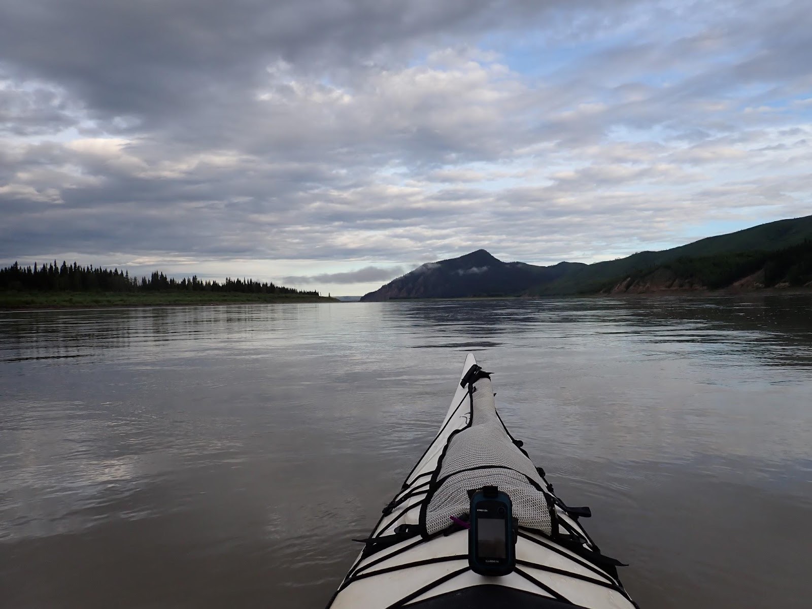
Fort Yukon is the gateway settlement for the Northernmost point of the Yukon 1000 (66.5 degrees N). Having travelled North since Eagle, it was now time to turn left for the last long Westerly reach to Dalton. We had almost 1200km behind us and less than 400 kms to go.
Over 400 people live in Fort Yukon, but all we could see from the far side of the river were a couple of roofs peeking above the treetops.
Turning west, the channels continued to consolidate into large flows, looping around well defined islands. The distant riverbanks were eroded and vertical, rising a few metres above the water. Islands in the flow featured similarly inaccessible banks, topped by mid size trees. As the end of our paddling day loomed we began scanning the islands for potential campsites. With a strong current eroding the upstream face and sides of the islands, the best options would be on the lee side of each island. The difficulty that presented was that the best part of each island only became visible just before you careened past. Any thought of splitting the odds between two islands on either side of a channel left us out in mid channel, too far from either island to successfully land. We’d burned off our enthusiasm or frustration and it was now too late in the day for paddling laterally upstream against the current.
Expect the maps to be wrong: The original mapping of the Yukpn River was done during the Cold War and there hasn’t been a lot of need to update it since then. There are seasonal floods that reshape the river in ways that are significant to paddlers but not to the people who update maps. On top of all that, river levels can make gravel bars appear and disappear within days or even hours.
Just remember that water ultimately flows downhill.
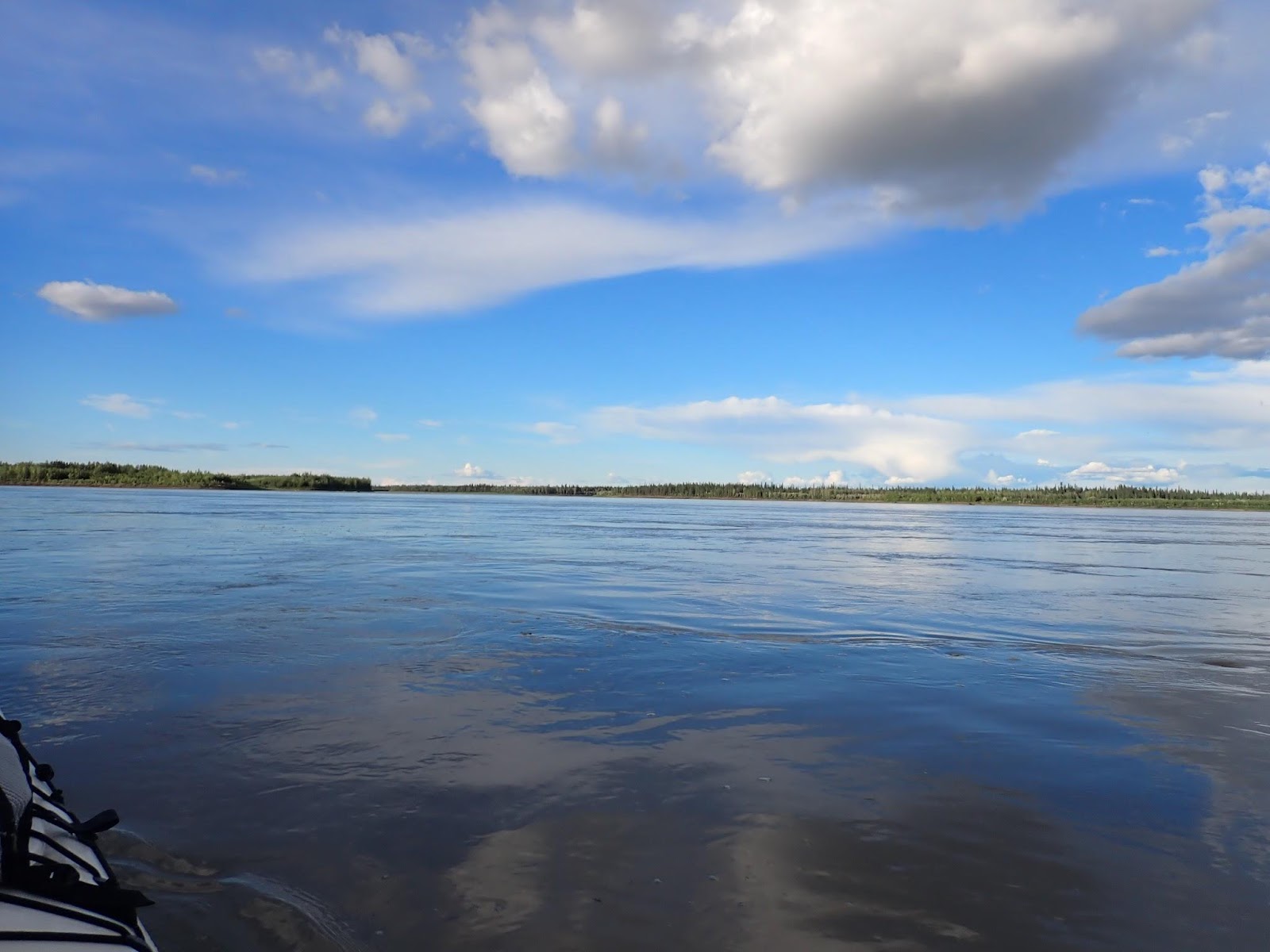
A second difficulty was also emerging. The sun was now low on the horizon and the glare off our GPS screens made it impossible to read the map without stopping to hold the GPS out of the sun. That was something we hadn’t accounted for in the setup of the boat – hours of paddling with the sun just above the horizon and shining in our eyes.
The low sun also made it hard to read the water. All we needed now was some wind on the water and some gravel bars to complete the misery.
The angels of misery promptly answered our prayers and 30 minutes later the wind kicked up some waves and the clear channels dissipated into a series of gravel sluices with no dominant flow.
Looking back on our adventure, there are several points that remain crystal clear in my mind17. The gravel bars immediately after Fort Yukon are are one of those points. Locked in my mind because we did everything right and it still went wrong.
The river swept right around a large island. My GPS track showed a path that followed the edge of the island around and into the next expanse of water. There was a channel there, but recent changes to the river from floods or ice had filled it with gravel and we were certain to run out of water. Discarding the plan yet again, we followed the main flow, continuing the long sweep to the right along a low gavel bar.
A little further and another stream cut through the gravel bar. Enough water to float the boat, but it could easily filter to nothing. The main flow was still carrying 75% of the water so we played the odds and followed the flow.
A third stream broke away soon after. As much flow as the first, but wider, so shallower. We stuck to the main flow, now half what it had been.
It happened twice more. Each time a branch broke away, it took less water than we were sitting on, but by now, that really wasn’t saying much.
The final branch, five or six hundred metres beyond the first passable branch, was the worst of them all. We scraped the bottom of the boat all the way round to where the first stream would have delivered us more quickly if not for our impeccable logic in following the flow.
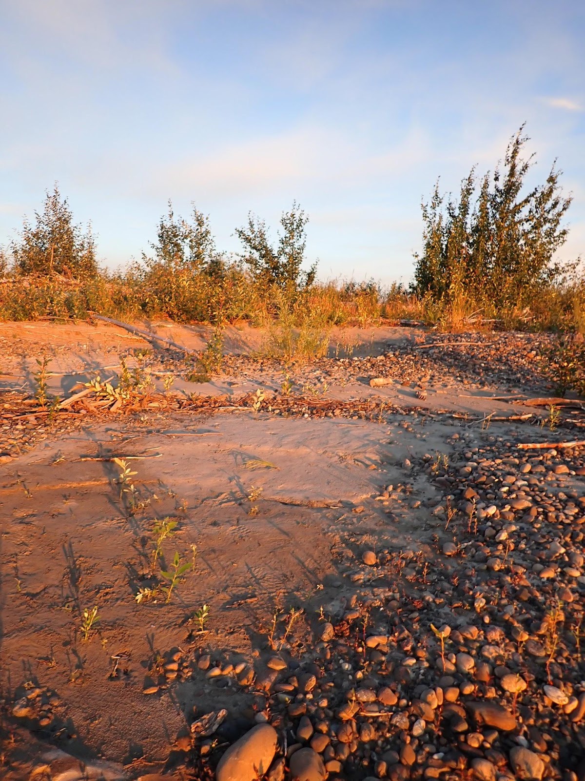
Overloaded by frustration from a day of gravel bars and bad choices, topped off by difficulty reading the GPS, we decided that enough was enough and the gravel beach on the next island offered enough flat ground to pitch our tent, even if the slope meant we would probably slide down the tent in the night.

It hadn’t been a great day, but thanks to our push late in the day, we’d put the frustration of The Flats behind us and tomorrow we’d be entering a section of river with a different personality. A personality we were more familiar with.
| Stop time: | 21:38:27 |
| Moving time: | 17:13:27 |
| Distance: | 194.2 km (120.7 mi) |
| Average speed: | 11.3 kph |
| Campsite: | 66° 33′ 59.93″ N, 145° 30′ 58.03″ W |
| Race Position: | 16th |
| Distance Completed: | 746 mi |
Saving this for last… The flats as seen from above. Pick the main flow and see how far you can follow it before it filters out…
Help encourage more posts by buying Steve a coffee…
Choose a small medium or large coffee (Stripe takes 10% and 1% goes to carbon reduction)
Or enter a custom amount
Your contribution is appreciated.
Donate- I realized just as I was about to hit publish that I’d only mentioned Circle AK once, briefly. We saw it only fleetingly as a series of buildings along the western bank. There were some powerboats running the river from Fort Yukon down to Circle through the day. Given they passed close by us, we were probably in the channels they were using, so maybe we were in the right channel at least some of the time. ↩︎
- At the finish line, Jon would note that water spouts were not unheard of on the river, even if it hadn’t been mentioned in the safety briefing ↩︎
- The average Australian willy-willy will blast you with sand and dust. A large one might relocate your tent. They’re usually just fun to watch. ↩︎
- Despite the winds we encountered at the end of the valleys before Circle, our challenges with wind were still another day away. How’s that for foreshadowing? ↩︎
- According to one source I checked, there are 105 synonyms for “challenging”. At least 20 of them convey the nature of The Flats more meaningfully than “challenging”. ↩︎
- People think they understand millions, billions and trillions, but really don’t. A million seconds is 11.5 days. A billion seconds is … 35 years. A trillion seconds is 35,000 years. ↩︎
- Just to establish that I’m not naive, I plotted our course using topo mapping and then checked it against satellite mapping, expecting that would prevent the exact problem we were having. ↩︎
- This is why you plan the course ahead of time. Then keep reminding yourself that this is the course you plotted before you were stupid with exhaustion. ↩︎
- We didn’t realize it at the time, but we were incredibly fortunate to have a still day, so we could read the gentle flows through the still waters. ↩︎
- hundreds of kilometres past the White River Confluence, the water is still opaque with ash ↩︎
- Kate named the boat for the tinking sound that the metal rudder made whenever it hit a gravel bar. We came to love that sound.
↩︎ - Finally you get to apply those really useful techniques for escaping quicksand that you learned from watching cowboy movies or Tarzan. ↩︎
- The widest channel strategy could well be the winner if the flow was higher. Add 2 ft of water and we’d have had half the problems. The riverbed was laid down by high flow and the the lower flow lacked the energy to reshape it. ↩︎
- Again, this might be the result of sleep deprived psychosis, but we have learned to embrace the madness ↩︎
- We’d decided early in planning that if we ever reached the point of unpacking topo maps, we were probably so far off the plan that having a compass would necessary because it probably involved walking to the nearest evac point. As an aside to an aside, the more practical reason for ignoring the paper maps is that neither of us can read them without glasses. ↩︎
- Waterspouts would make two things, but all we had to do there was steer between them. ↩︎
- like passing under the bridge after Dawson ↩︎

One thought on “2024 Yukon 1000 – Day 6 – Wednesday”