
Wrist pain – Smoke but no fire – Dawson – More smoke – Bear Prints – 9.4km from the Border
| Start Time: | 13/07/2025 05:11:24 |
| Location: | 63°28’7.6440″N 139°43’35.0760″W |
| Rest Time: | 07:11:40 |
I woke at midnight having somehow rolled on top of my wrist. I think I was already sleeping fitfully because of a constant splashing only a few metres from the tent. We’d later realize that it had been beavers slapping their tails in displeasure at our invasion of their territory. We hadn’t noticed the small beaver lodge tucked into the upstream end of the sand bar we were camped on. Absent that realisation, the splashes throughout the night sounded like the river was eating the few metres of island that separated our tent from the water.
I’d strapped my wrist with an elastic tube bandage before turning in a few hours earlier. The bandage was doubled up to increase the compression and hopefully drive a bit of the swelling back up my arm. After two hours of sleep, there was little sign that it was having any positive effect. It was however making my thumb and fingers go numb.
If the swelling didn’t abate overnight, we were going to have to make a tough decision about whether to withdraw at Dawson, again.
We’d withdrawn in 2023 after I had breathing issues triggered by wildfire smoke. Aside from the disappointment of not finishing, it had set up a chain of logistical challenges which had led to an adventure of a different kind. Looking back two years later, our ad-hoc hitchhiking self extraction along the Top of the World Highway had been unique experience. Not one we were keen to repeat. Even though we’d solved the problems in 2023, it had been with some very targeted assistance from Jon and had involved a film crew who were shuttling a truck to the finish.
While Kate slept, I was lying awake, plotting exit options. Jeff from Texas would be driving West’s truck to Dalton, but West and Paul were now likely to be well ahead of us. No reason to think Jeff wouldn’t leave Dawson as soon as they did. There was another team from Whitehorse who also probably had a driver. Again they were in front of us, but not by as much as West and Paul. One or two other teams with support vehicles might be behind, but they could also be withdrawing, or have no spare seats.
If we withdrew at Dawson, we would need to find a ride to Fairbanks to be reunited with the bag of clothes and travel items which we’d sent ahead by FedEx. It was also the point where we could link up with our pre-booked flights. All the permutations of how we would get to Fairbanks – or get our package redirected back to Vancouver, by which time we’d be trying to get FedEx to return a package to a Victoria on the two days we’d be there, before we would need to have it further redirected to Sydney – were bouncing around my head until I drifted off to sleep again.
A little later I remember lying awake wondering if there would be any value in calling the race medical line. They operate 24/7 and racers can get medical advice without any penalty. I concluded that the inevitable response would be to stop doing the thing that was making it hurt. There was no point bothering a doctor for advice I didn’t want to take.
I woke again about 2am. I’d managed to tangle myself up as I’d rolled over. At some point before I’d dozed off I’d hooked my hand into a lashing point up the inner wall of the tent, providing a little elevation to my bandaged wrist. That seemed to have helped and it had resolved about 1/3 of the swelling. I found some anti-inflamatory capsules in the first aid kit, made a fairly casual assessment about what another 200mg would mean to my recommended daily dosage1, and knocked them back.
Waking to our 3:15am alarm, we both agreed that trading an hour of race time for an extra hour of rest on land would be strategically judicious. My wrist was almost back to normal, so I spent part of the extra hour wrapping it with elastic KT tape to maintain the compression into the day.2
In the course of six or seven hours we’d managed our fairly debilitating overuse injuries back to the point where we were comfortable progressing past the checkpoint and cut-off at Dawson. The previous day, when my wrist had been feeling particularly grim, I’d torn a length of duct tape off and tried to wrap it around my hand to act like one of the braces gymnasts use on the parallel bars. It had been an abject failure.
I’d need to talk to Tom Simmat when we got back to Sydney and ask him how he did it3.
Hint: Wrap a few metres of duct tape around your paddle shaft for quick access in an emergency, or easy day to day use. If you spool it up carefully, it lasts as longer than it would on the original cardboard spool. This only works for kayakers – a bit of advice I got from Stewy Nichol as we paddled the tree strewn section of the Murray Marathon day 2.
From this point on we’d have to be cautious about overloading our wrists. No racing the other teams4.
The Duckers suddenly appeared from between two islands across the river, then disappeared just as quickly, just as we were closing the hatches on our boat, ready to start our day.
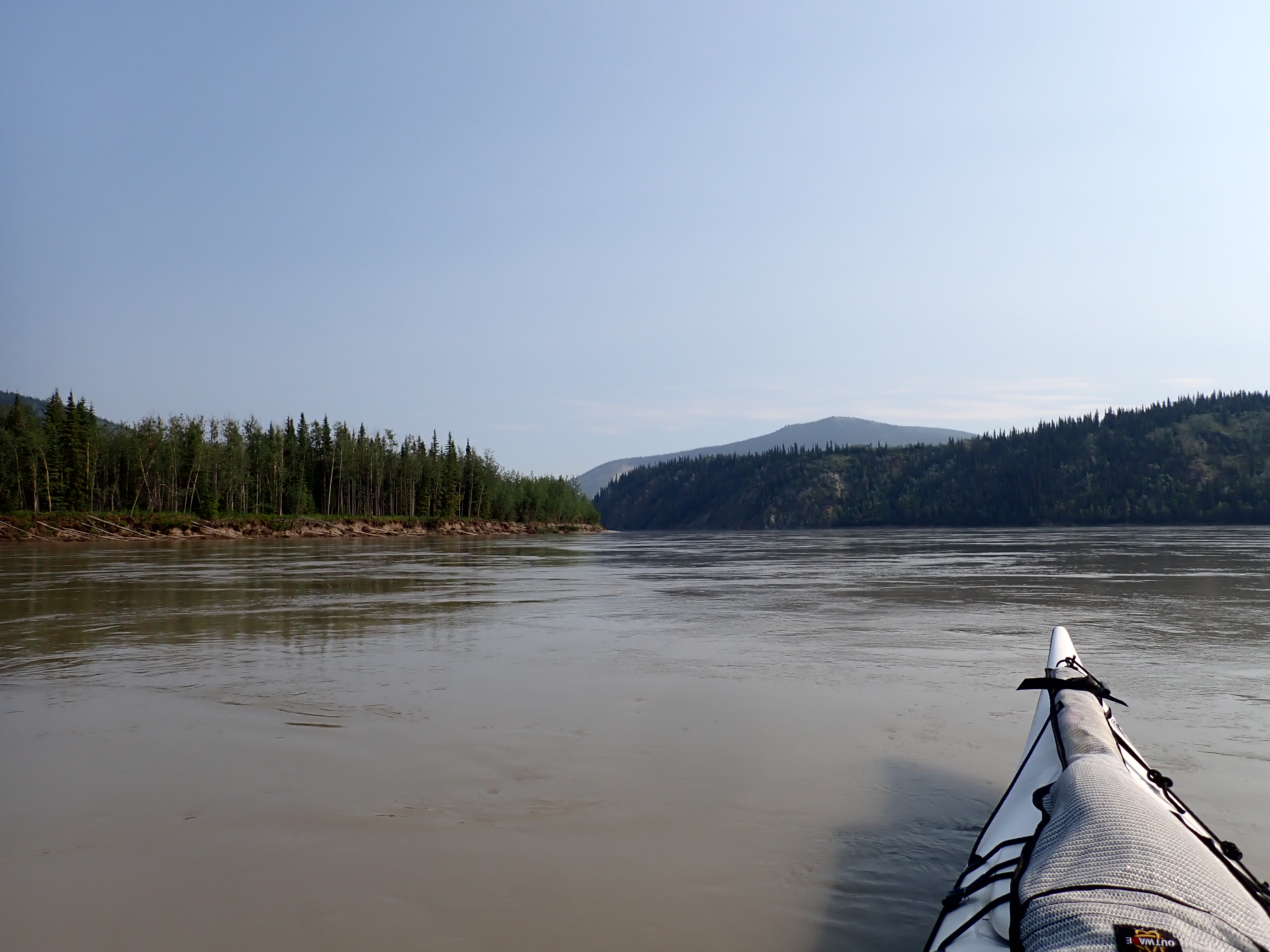
Which brings us to the reason they disappeared. The previous day, we’d seen a huge plume of smoke rising high above the ridgeline ahead of us. Overnight, the temperature had dropped in the river valley, and that smoke had dropped with it.
Visibilty was down to around 200 metres, making it difficult to pick out the channels ahead. If there had been another team across the river, neither team would have known about the other. If it wasn’t for the current steadily roiling past our island, we might have set off in the wrong direction.
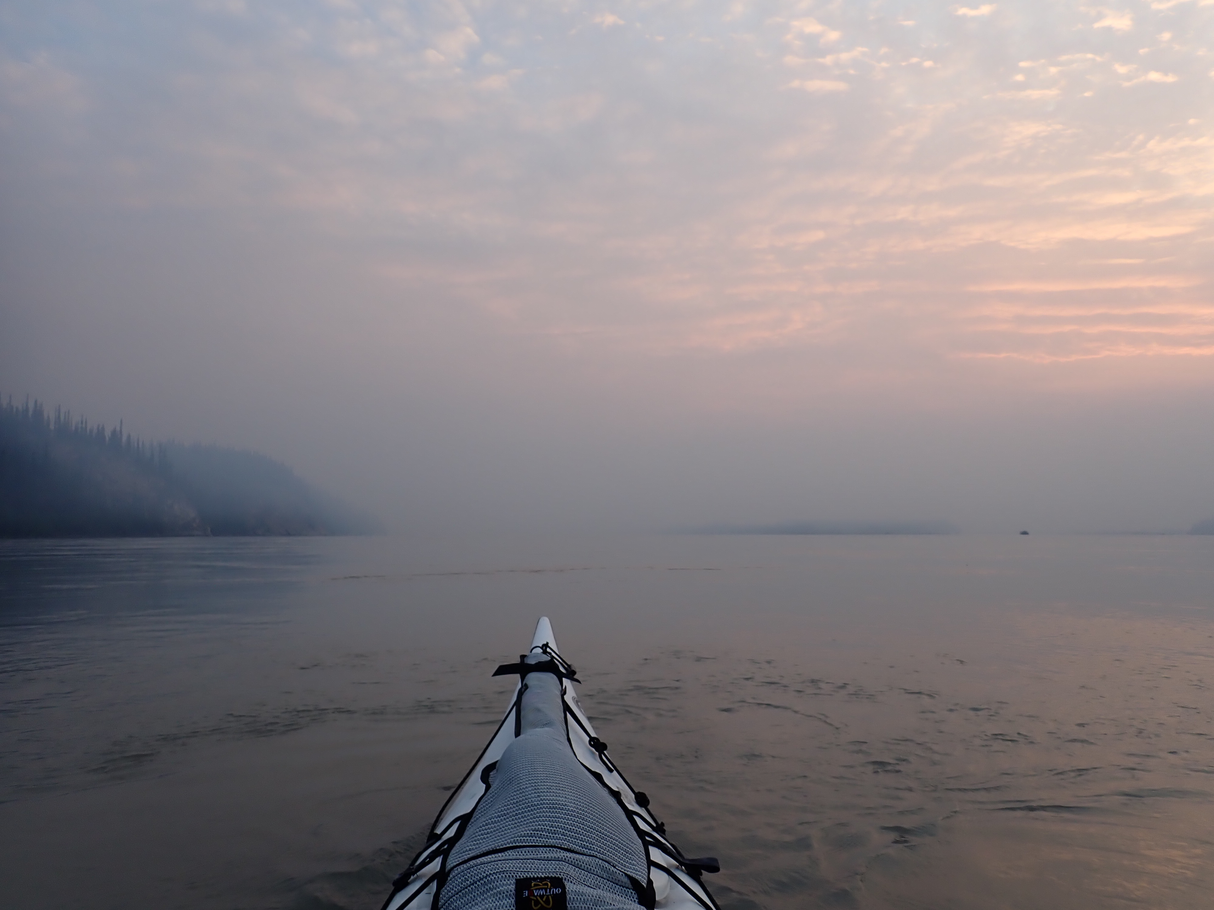
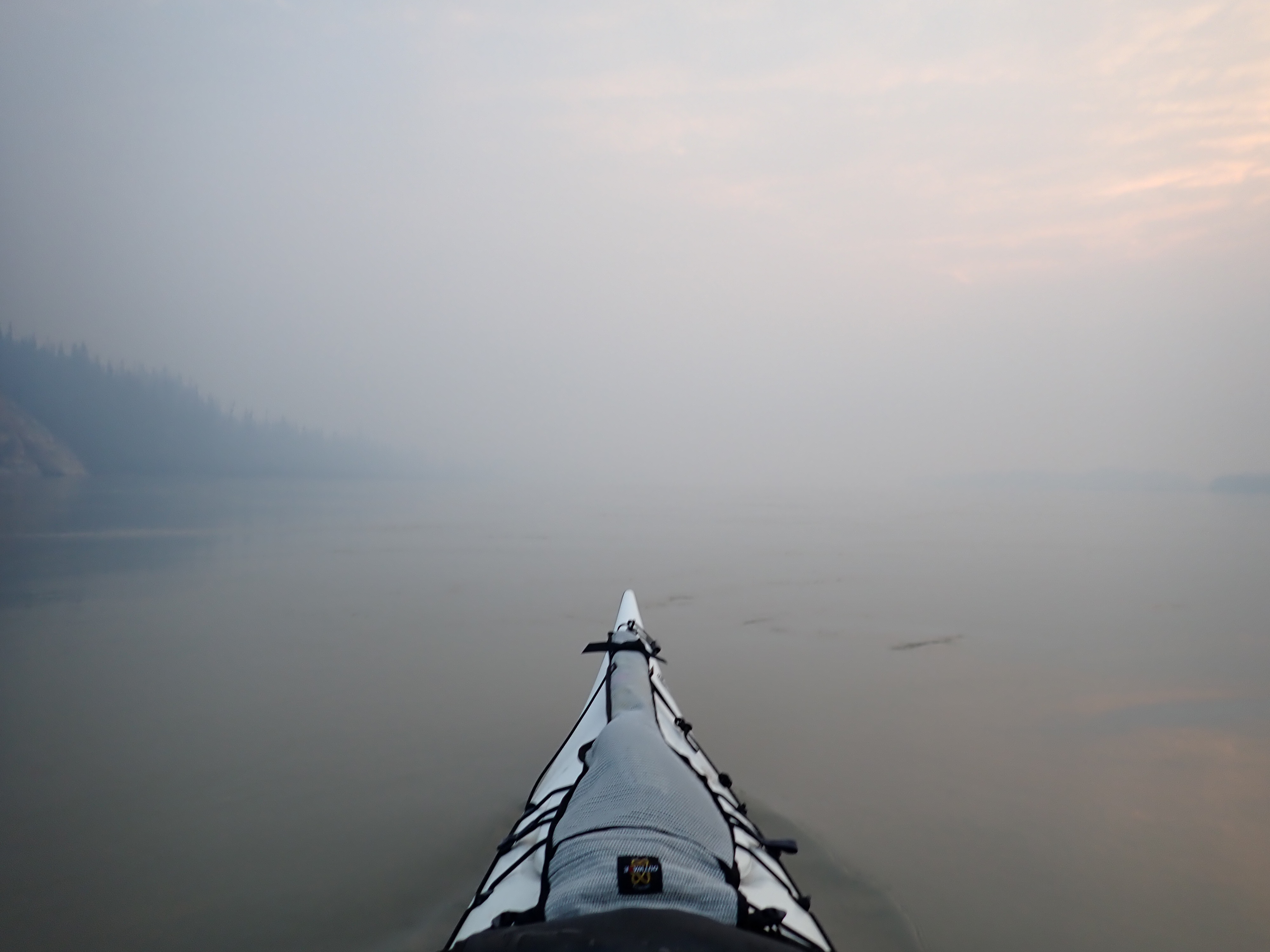
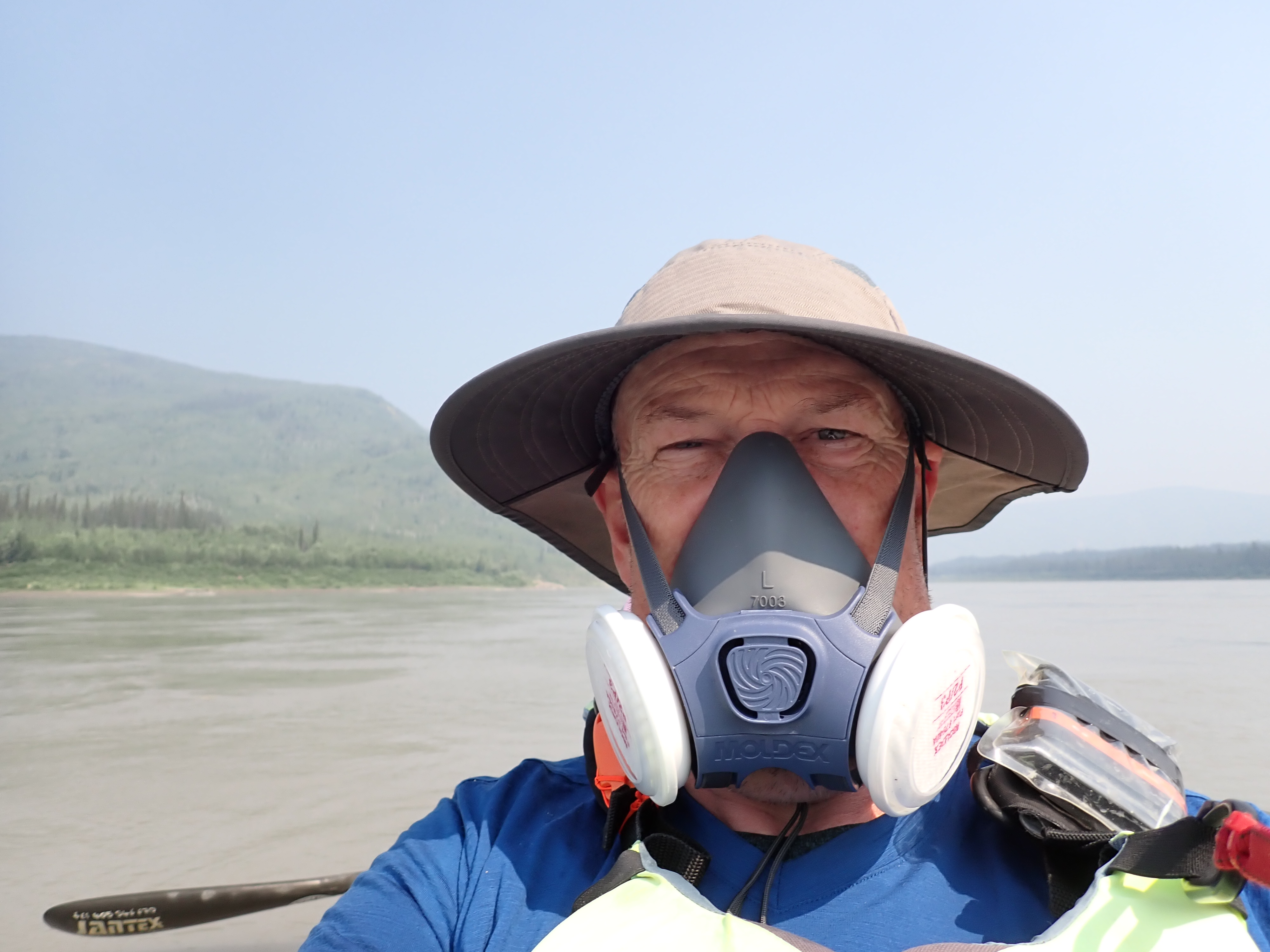
The smoke didn’t have the acrid burn I associate with fresh smoke, even though it was too thick to see through. That alleviated our initial concern – I’ve had bad reactions to wildfire smoke in the past, withdrawing in 2023. Our risk mitigation is to pack industrial quality masks. They’re good enough let me breathe freely, but paddling in a rubber mask is neither pleasant nor particularly efficient.
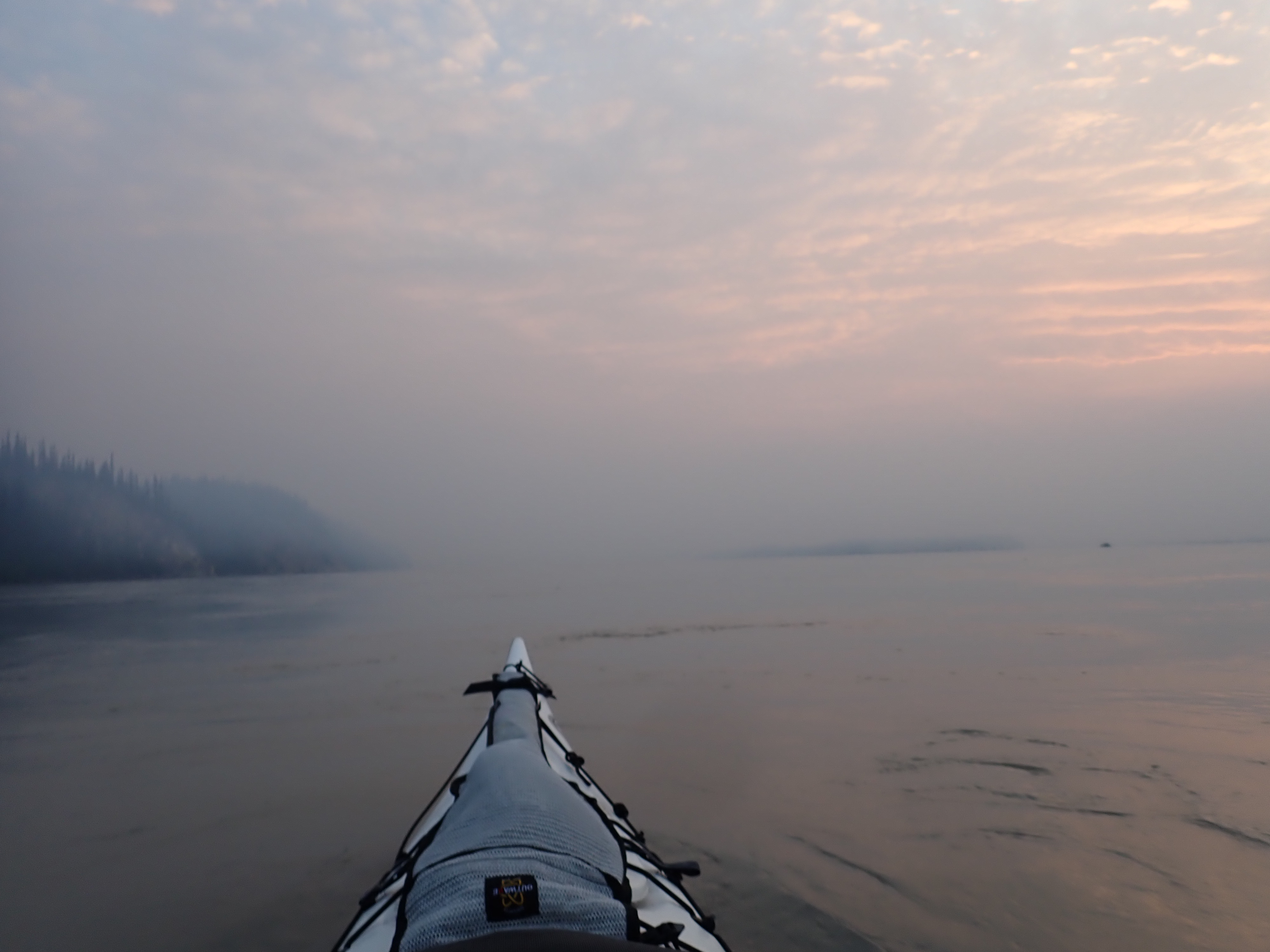
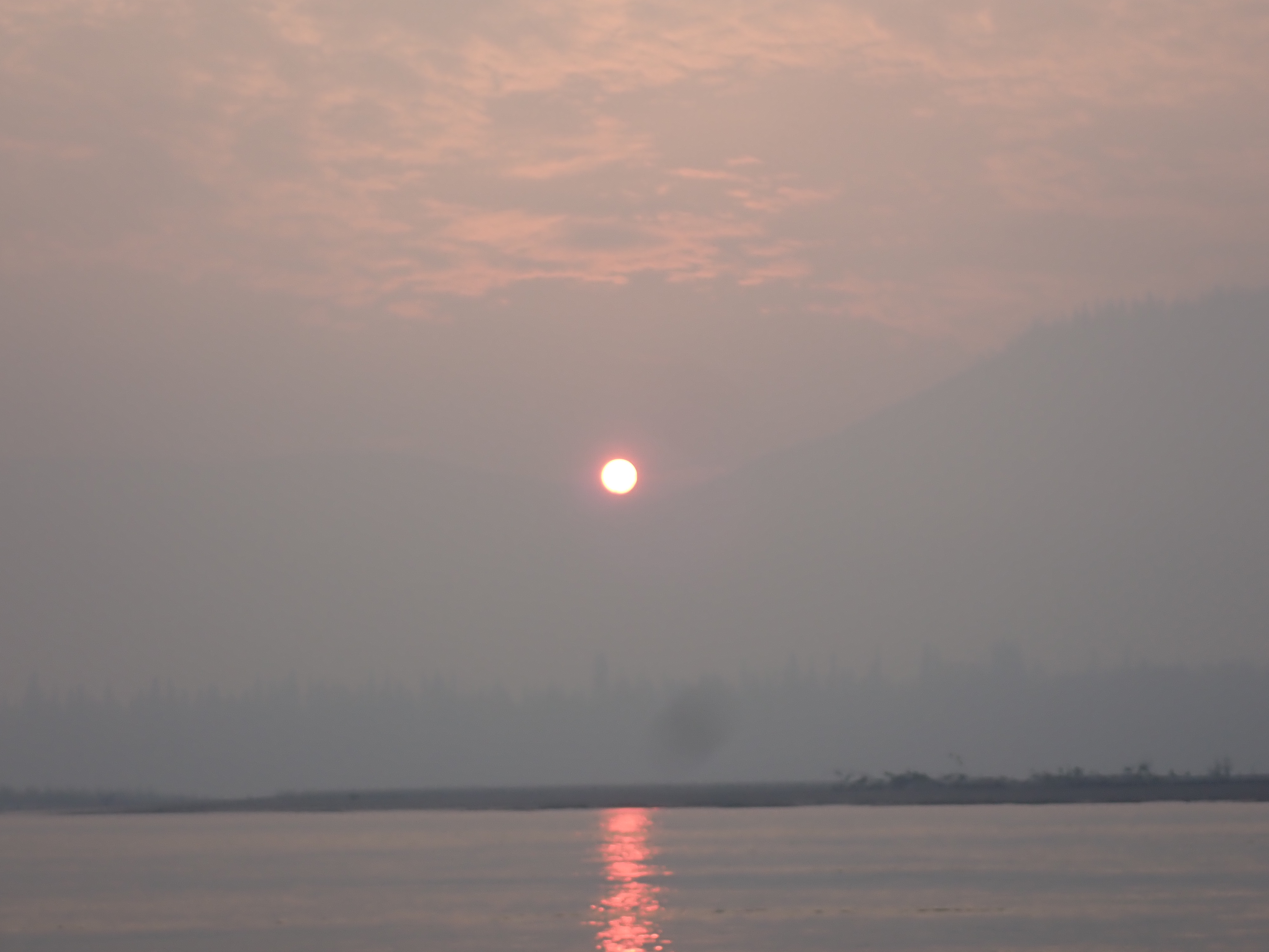
For whatever reason, the smoke wasn’t bothering me5. After an hour it had started to lift from the water, becoming a blanketing layer above our heads. As the sun rose over the ridgeline to the east, the smoke was thick enough for us to look directly into the sun, which glowed like a small orange ball. Over the next hour, the rising temperature, and I expect convection from the warming river, lifted and dissapated the smoke entirely.
The last hour into Dawson was paddled under a clear blue sky. The rising smoke we’d seen the previous night seemed to have vanished. That seems to be the way of things with wildfires. There’s a steady smoulder which suddenly breaks out into a new gulley or over a ridgeline and explodes into a column of smoke and ferocity with the fresh fuel, then settles back to smoulder again.
I’ve always enjoyed the last hour into Dawson. Not just because I feel like I have some sort of pseudo-spiritual connection to the place. I don’t really, it’s named after George Mercer Dawson – a pioneering geologist and surveyor from the Klondike goldrush era. There’s no link that I’ve ever been able to find. The Dawson family name is supposedly a corruption of David’s son which possibly arose from church records or the Domesday Book, so the world is full of unrelated Dawsons. A surprising number of William Dawsons were surveyors in the colonial period of Australia.
It’s also not because the river gets any more scenic or easier to paddle. It remains wide and open, sweeping from left to right around islands. Towards the end of the Yukon River Quest in 2019, this was the bit of the river that nearly broke us. We’d been going well – to an acceptable level of exhaustion and hallucinations – when we made the mistake of asking a random local on the river bank how far we were from the finish in Dawson.
Why did we ask when we had a GPS, maps, and race notes that told us exactly where we were and how far we had to go? Honestly, I think I just wanted to talk to somebody who I hadn’t been sitting in the same boat with for the past 50 hours.
The answer we got was 30km. We set off towards the finish line with the knowledge that we could turn up the pace and run the tanks all the way to empty over the next two hours.
There are conflicting schools of thought amongst ultra marathon paddlers with regard to training. Kate and I are in the long duration camp. Others are in the high intensity, short duration camp. The latter tend to be faster, while we think the former know their limits better. We regularly train out past 4-6 hours of continous paddling, so we know what it feels like to run your energy down to zero coming back from 3 hours away. We also have a good sense of how hard we can go to hit zero in 1, 2, or 3 hours time. When old mate with the fishing rod said 30km, we set off at a pace that guaranteed we would crash after 30 km.
What old mate should have said was 60km, because that was where he was. That was what my race notes and my GPS were telling me too. But it was our first time on the river and there’s always some variance between the plan you made at the kitchen table and the real distance on the river.
We had been 15km out at Coffee Creek which was the previous checkpoint.
But that day, we were tired and judgement impaired and consequently put too much stock in an otherwise inconsequential estimate from a fisherman who had probably paid no attention to how many kilometres he’d powered upriver in his boat that day.
As a result, when we hit the wall we were still 30km from Dawson, completely spent and overwhelmed by the realisation that we were 2 more hours from the finish. We drifted down river dejected and destroyed, debating whether we could just drift the last 30km to the finish. We might still have finished in the top 10 by drifting at the 5-6km per hour offered by the current. In a final fuck you to our emotional collapse, the current then flicked our boat into a huge eddy which sent us drifting back upstream away from Dawson.
We circled on the eddy for a few cyles before we came to the inevitable conclusion that as close as we were to the finish, the only way we were getting there was through active propulsion and bavigation. It ended up taking closer to four hours than the two it should have taken, but we finished.
Hint #1: Don’t ask. Don’t tell. If an ultra paddler asks you how far it is to XXX. Nothing is more soul destroying that being told the wrong distance. If you’re over, the paddler will crash before the finish. If you’re under, they’ll cross the line knowing they could have gone faster. Shut your damn mouth, even if you know.
Hint #2: As the racer, it’s your job to know where you are. If you’ve done your job, you don’t need to ask. If you want human interaction ask about the weather, how many fish they’ve caught6, of if they’ve seen any other racers.
Hint #5: Keep track of where you are. We run our races, not from a map, but from a sheet of numbers. Times and distances to landmarks on a laminated card, taped onto the deck. Think of it as instructions for future you. When you are tired and stupid, remind yourself that you printed it out when you were not tired7.
If the Yukon 1000 can be likened to climbing Mt Everest, that spot 30km from Dawson is our Hillary Step.
Even though the checkpoint is at Dawson, the crux for us is 2 hours upstream. From there to Dalton, it’s all easy for us8 which makes no sense because you have 700km behind you and supposedly9 900km in front.
Rolling into Dawson we veered right towards the Yukon 1000 flags fluttering over the dock where an old riverboat is on display.
Each year in the briefing Jon makes it clear that there is no need stop for the check in. Unless you’re past the cutoff time, you can just stay out in the main current and he’ll just wave you through without any requirement for a verbal interaction.
Ignoring Kate’s protests about leaving the current and entering the shallowing approach to the dock, I lined up on the flags to share some thoughts I’d been developing on the nature of body odours, the flatness of camp sites, and the merits of repetitive food selections as they applied to an ultra distance event like the 1000. It also seemed like a good opportunity to secure a video record of our passing which I’d be able to snaffle later for my own purposes. Jon for his part, shared the view that it was in fact a race, we were actually on the clock, and there were no part-rewards for getting part of the way to the finish line.
You’ll note the voice of Ben Lott at the tail end of the video clip below with the helpful advice that Alaska is on the right10.
It was 11:30 am local time. We were through Dawson, and on our way to Alaska. We were 9.5 hours inside the 9pm cutoff, although looking back through my notes, I see conflicting references to 9pm and 6pm. Jon varies it each year according to how well he thinks the river is flowing and what he deems to be an acceptable rate of advance. There might be some lattitude for paddlers who had had a bad start but were bouncing back performance wise – at the discretion of the race director is the bottom line.
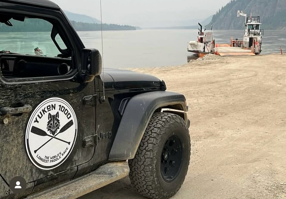
Departing Dawson we swerved out of the path of the car ferry which was running a load of cars across the river.
About 2km further down river, I looked over my shoulder to see if I could finally dispell the image I have in my head of a bridge across the river. There isn’t one. I just have one lodged in my memory from two years ago when I was a bit addled and managed to hallucinate up a two lane concrete-piled bridge that runs from bank to bank . Even knowing it was a hallucination, and seeing again that it doesn’t exist, I can’t dislodge that memory.
Such is the power of hallucinations.
Back to the race, there was an active fireground to the west of Dawson which we couldn’t see from the river. What we could see was a helicopter making runs with a monsoon bucket. It would appear over the ridge, sweep down the hillside, fill up from the river, before heading back over the ridge again. From the expanse of rising smoke, it was a drop in the bucket.
We’d been tracking the significant fires to the east and west of Dawson since before we’d left home. The North American tracking systems for wildfires and smoke are really good, although you don’t want to zoom out too far and see how much of the North American continent is simultaneously ablaze during wildfire season.
Beyond Dawson there were three more fires that we’d made a note of before the race. Both Eagle Village just across the border, and Circle at the start of the flats had fires burning in their back blocks. Both settlements had small populations and the fires were probably from human activity.
A third fire had rated a mention in the safety briefing. Around 40km past Dawson there was a wildfire burning through an area of what appeared to be scrubland on the northern riverbank. After pointing it out on a map, Jon had suggested the obvious mitigation was to paddle down the other11 side of the river. Seemed like sound advice.
We soon encountered the smoke. It was sitting in the river valley and got progressively denser over the next three or four hours. Unlike the morning smoke, this was fresh enough for me to dig out my smoke mask. We spent maybe four hours paddling in smoke, expecting to finallt find the source
fire around each approaching bend.
It’s worth noting that the thinner smoke in the afternoon was less breathable than the thick obscuring smoke of early morning.

I think I will always find it a little disconcerting to be paddling forwards into smoke, especially out there in the vast timberlands where fires burn uncontrolled unless they are endanger people or infrastructure.
We never saw the flames or even a smouldering remnant of a fire. By mid afternoon, a westerly wind had started to pick up, exhausting the smoke from the river.
When it comes to notable landmarks between Dawson and the Alaskan border, there is as my grandfather would have said, three quarters of five eighths of fuck all.
There’s a broad river running through a wide valley, flanked closely by steep hillsides. Ocassionally lowland areas spill out from base of some hills, but mostly it’s just steep flanking terrain. The hills are quite effective at funnelling wind straight into your face. Even when the river has reverse direction the wind is predominantly head on.
Ocassionally there are islands. For long stretches there aren’t.
One thing that struck me as we paddled, was how the scenery changes according to the weather and time of day. One of my favourite memories from 2024 was navigating through some of the islands and channels on day 4. This year, we were slightly ahead on time, and reached that same spot late in the afternoon as opposed to early on day 5 like last year. The scene was completely different without the subdued tones of twilight and the cloud that had descended into the valley. I was probably also less receptive to beauty at the late end of the day.
Knowing we were approaching the Alaskan border we checked our position against our pace and realised we faced a tactical choice.
Under race rules, you can choose to stop any time between 10pm and 11pm for your six hour overnight stop.
We were now within 20km of the border and if we carried on to 11pm, we’d be crossing into Alaska. Probably around 10:45. Crossing the border means crossing into a different time zone, sending the clock back an hour. 10:45pm Yukon time would become 9:45pm Alaska time and we’d have another hour and a quarter to find a campsite. It would also turn our day four into a 19 hour day.
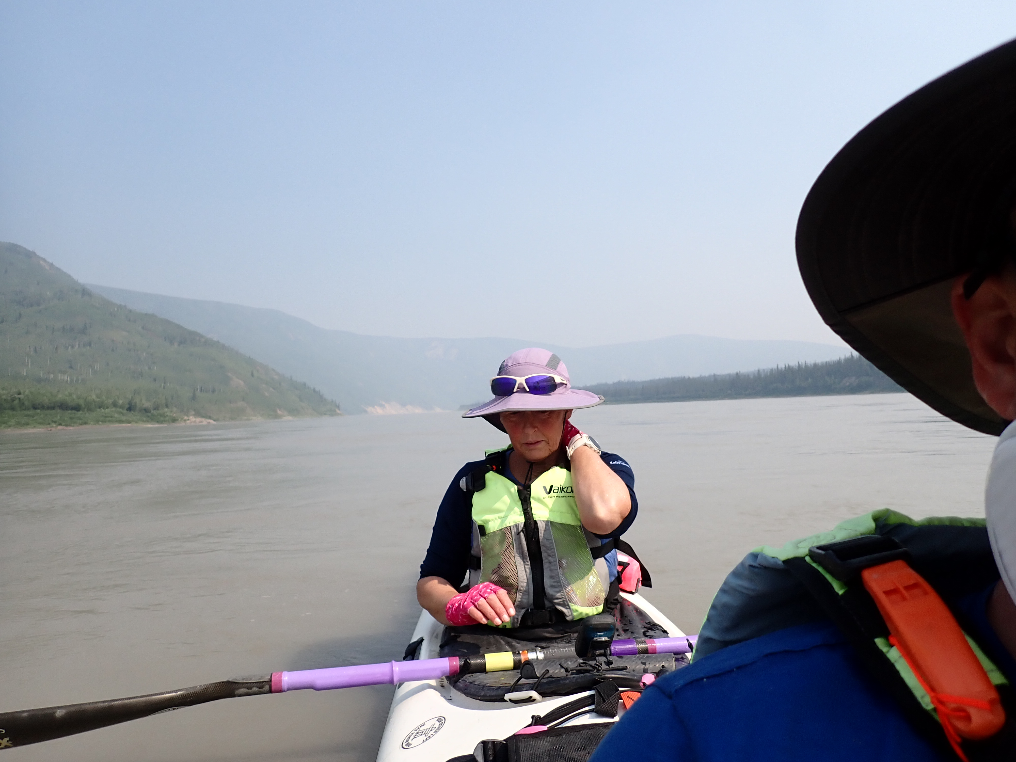
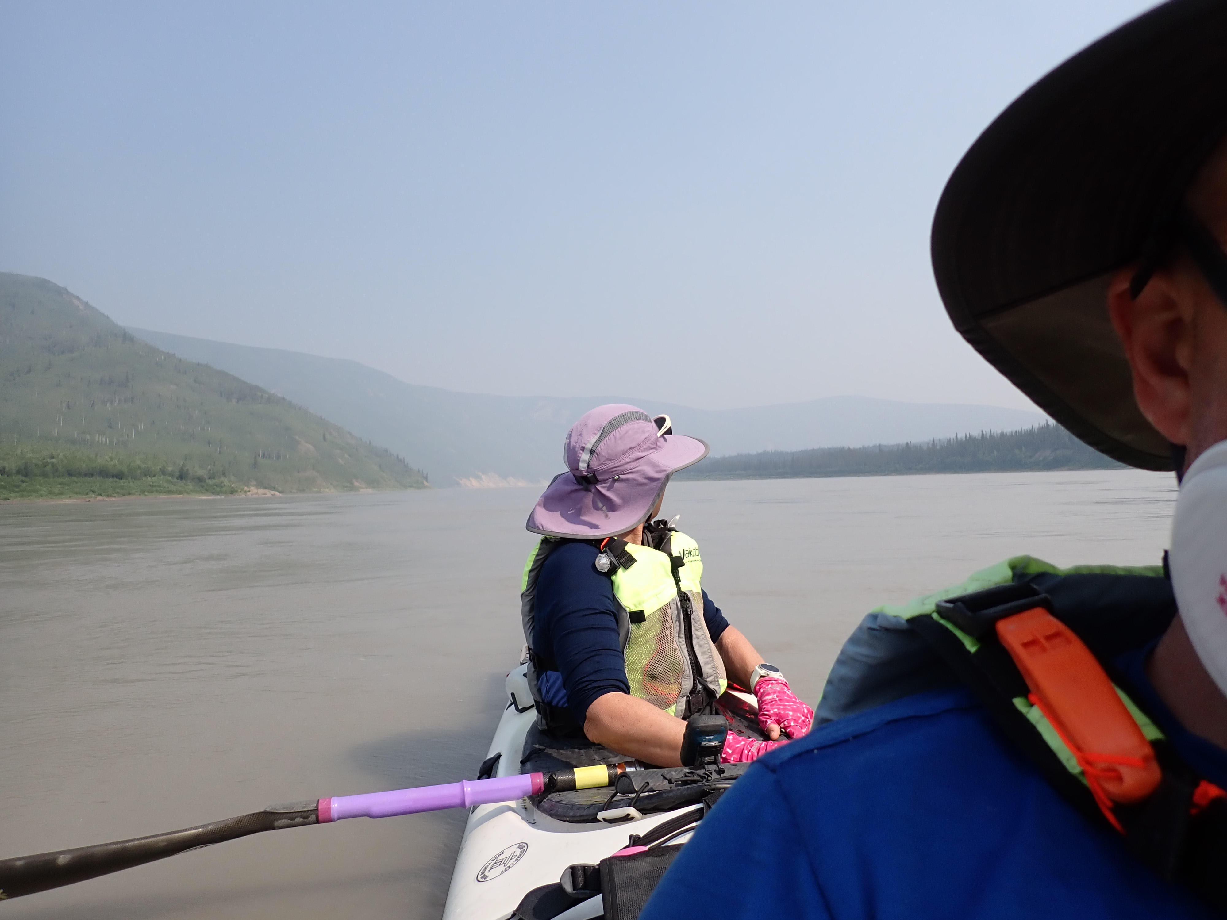
24 hours earlier we’d been suffering with wrist problems. The wrists hadn’t magically improved. We were both noticing a compounding level of wrist pain. It hadn’t reached the crescendo of discomfort we’d experienced on the previous day. There hadn’t been another team to chase, so we’d set our own pace, which had helped.
Not terrible. Not great. Hopefully, manageable.
The degree of discomfort was one input into our decision to cross the border or not. Essentially whether we wanted an addition hour on our wrists today, or tomorrow after another six hours of rest and recovery.
Another consideration was the availability of campsites. In the approach to the border we knew we had three clusters of islands before we would find ourselves in a valley for 10km to the border, then another 10km on the Alaskan side before the next island. 10km furher and we’d be at Eagle Village where the Customs checkpoint is located.
If we crossed the border, Eagle Village itself was probably out of range before 11pm and the reachable island was a big midriver island that carried two questionmarks. Firstly, being large enough to still appear on the GPS screen while zoomed out to 20km, it was also large enough to have a resident bear (or bears). It was potentially bear bearing one might say12. A second consideration was that this particular island is directly in front of the indigenous settlement at Eagle. That in turn raised two concerns. a) that any assumed residential bears would be habituated to humans13; and b) it might have been the island where some teams had camped in 2023 only to find themselves between the local shooters on the mainland, and the targets they had set up on the island. A hasty satphone call had been made to request a cease fire.
It’s worth pointing out that this account of our decision making process might make it seem like there were decisions being made on the fly. Out on the river the hours roll by ever so slowly. The next bend in the river requiring navigation is frequently an hour or more downriver. Decisions extending beyond the visible bend can be considered over multiple hours.

We’d settled on camping before the border on this day and making day 5 our the big 19 hour day. We were around 820 km into the race. 10 km short of the Border (830km) and 20km from the border checkin at Eagle Village (840 km). A 19 hour day would be enought to cover the distance from Eagle to Circle (1080km) or at least get us close enough to complete the 130km transit of The Flats on day 6.
Similar to our views on Eagle Village, we would prefer to avoid camping in close proximity to the community at Circle.
We were midway into the first of three island clusters before we settled on an island that Kate deemed suitable. Several previous islands had been vetoed by Kate who felt the copse of trees on each island had been large enough to sustain a bear.
Our first acceptable candidate island was mid sized affair with a patch of low bushes at one end gaving way to a plateau of sand standing about a metre above river level. It looked very inviting.
We wanted to pitch our tent on the elevated patch of sand. It looked level, and it had good sight lines across the rest of the island. Pitching the tent with exposure to the wind might help dry it as well.
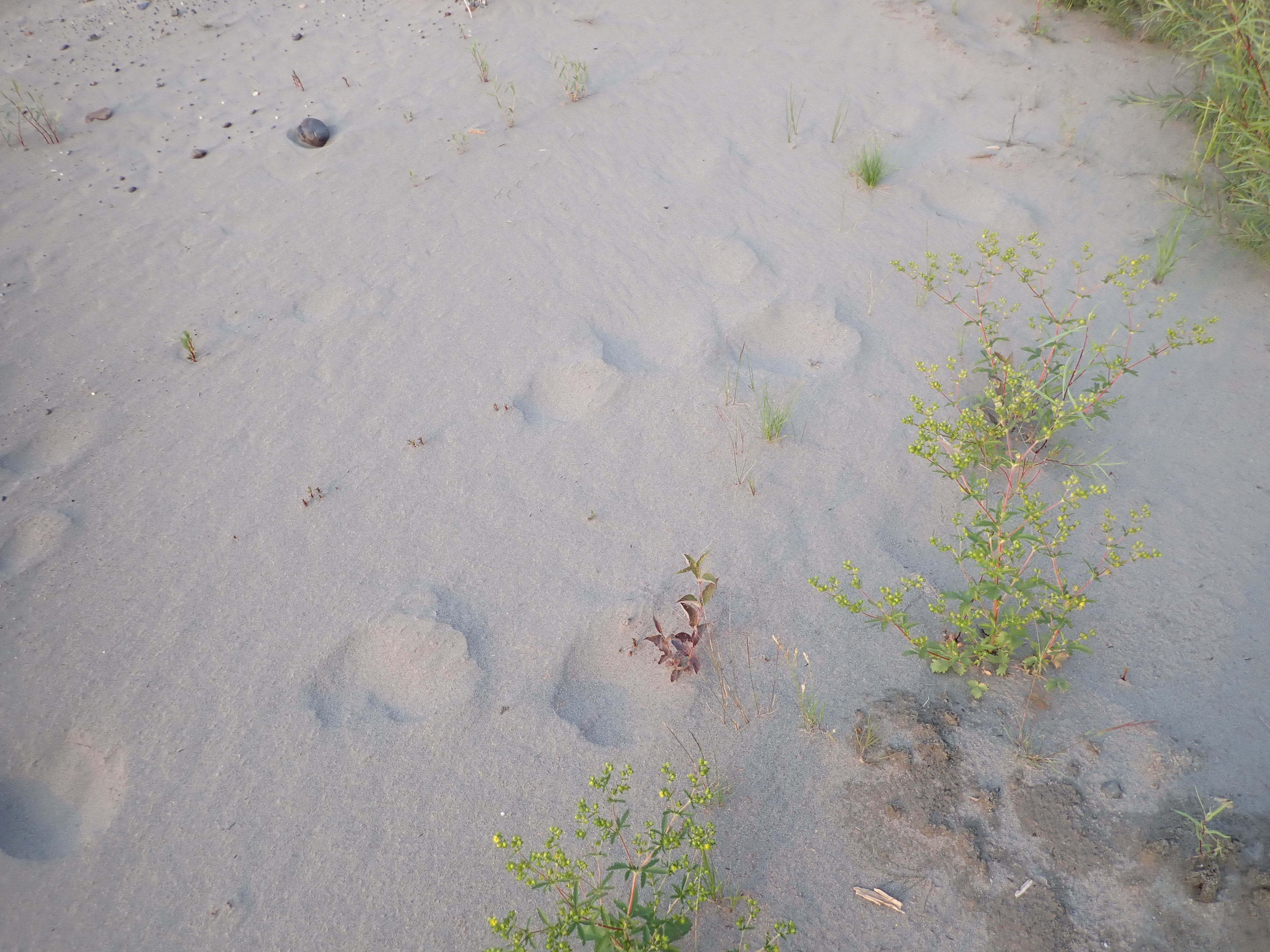
Because the sand plateau was above river level, we couldn’t see the moose prints until we scrambled awkwardly to the top with our gear. Reaching the top, the distinctive footprints of moose were the first thing we noticed.
Moose are, I think, an underrated risk on the 1000. They are very large, potentially defensive around young, and capable of doing a person some serious harm. Advice for dealing with a charging moose is to get behind a tree or similar protective barrier. As we’d chosen our campsite for its lack of trees, we were poorly positioned for a moose encounter. When we noticed that the moose prints seemed to be two distinctly different sizes, our concern expanded to include a mother with a calf. The tracks in the sand were fresh and well defined, but starting to decay. Probably a day or two old.
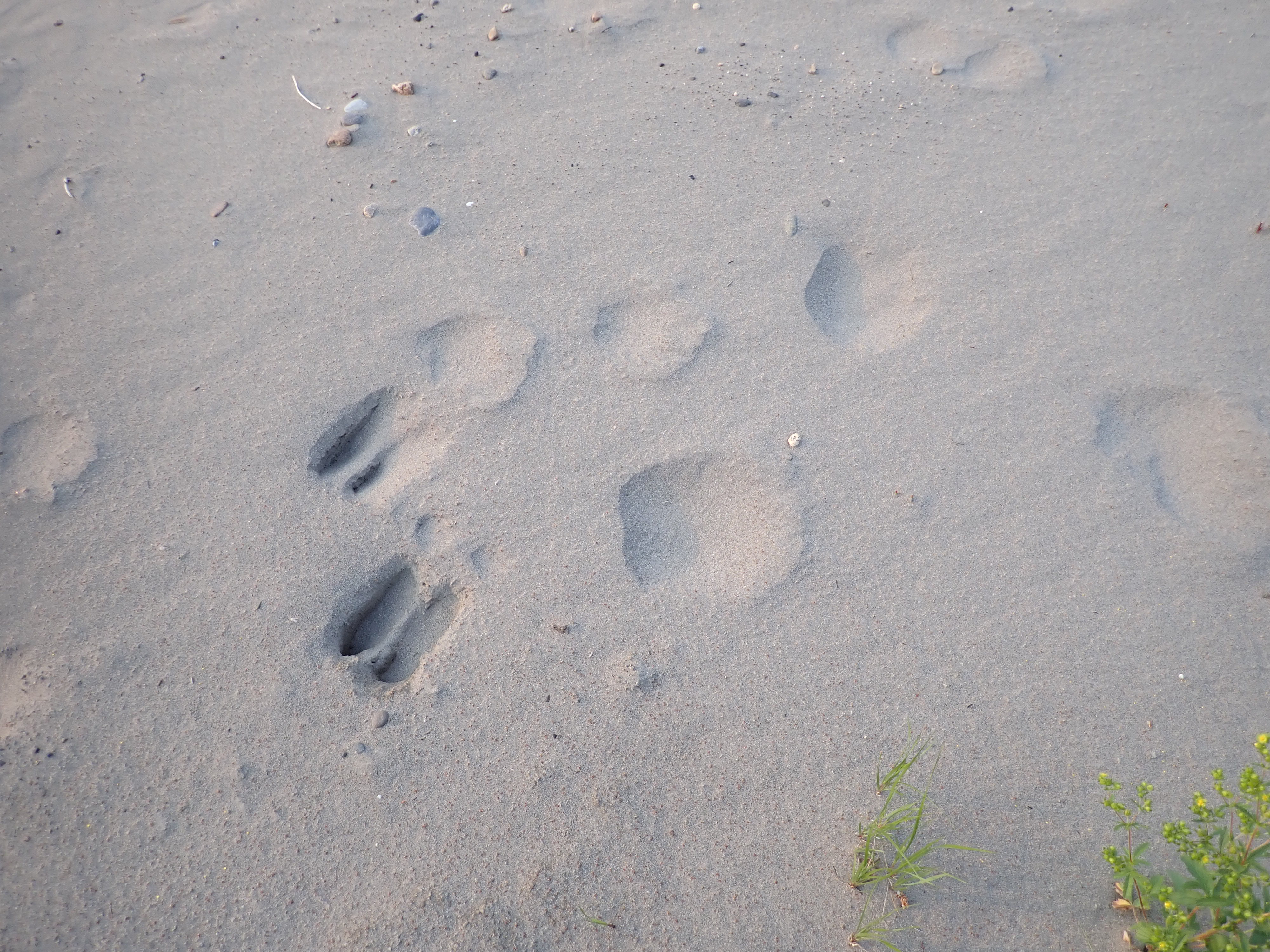
We spent a few minutes debating whether the moose prints traversing our proposed tent site were grounds for relocation – I’ve been told that bad moose encounters are often moose travelling a game path that somebody was naive enough to put a tent on top of14. Then we noticed the other prints. Initially I’d overlooked the big round holes in the sand. 8-12 inches across, they were initially just round holes about 4-6″ deep in the soft sand. Then I noticed that there was a discernable sequence of holes traversing our chosen patch of sand. Looking more closely, I could see signs of claws on the leading edge. They appeared to be a few days older than the moose prints, but they were recent enough to confirm the presence of a sizeable bear on the island. Like the moose prints which came in two sizes, the bear prints also appeared to be two distinct sizes.
The bushes which had previously seemed too short to obscure a bear, now seemed quite large enough.
Time to head back to the boat.
The map showed we had two more island options ahead before we would be forced to cross the border to in pursuit of a suitable campsite.
Back in the boat and paddling, we discussed how the race rules would apply to our current situation. If you stop for the night and find a bear or signs of a bear, you are allowed, encouraged even, to pack up and relocate a safe distance down river15. That was what we were doing now. If the upcoming handful of islands were equally unsuitable, we would, thanks to our lost time on land, be forced to cross the border after the 11pm stop time. That in turn would trigger an extra hour of paddling as our clocks went back. So even though we would technically be around 15 minutes past the mandatory stop time, we’d end up with another 45 minutes paddling to get ourselves to another campsite on the Alaskan side.
Aside from the islands, there were intermittent terraces at the bottom of some of the steep hillsides. If it became desperate, you could make them work, but they were definitely campsites of last resort. Islands in midstream continued to be our preference.
We were almost at the point of a forced run to the border when we came across a workable option. It was a gravel and silt shoal on the leading edge of a fairly large island. The trees were definitely big enough to hide a bear, but any bear would have to cross 200-300m of open gravel and silt to assuage its curiosity. That seemed good enough for us given the paucity of campsites for the next two hours. It was still a “shoot your travel agent” class of campsite. The biggest positive was probably that it wasn’t raining. We quickly settled into our tent for an acceptable nights sleep.
We had not seen another team since The Duckers had slipped past 18 hours earlier.
Now 5km from the Alaskan border, we were further ahead of last year than we had been at the start of the day. Despite the wrist problems, we were continuing to build on our improved pace. Our wrists remained manageable and we were a little more confident that we could face the 19 hour day that awaited us.
| End Time | 13/07/2025 22:19:20 |
| End Location: | 64°38’17.9160″N 140°52’58.3320″W |
| Altitude: | 275.0 m |
| Distance: | 209 km |
| Paddling Time: | 17:04:06 |
| Non-moving time: | 00:21:09 (response to bear tracks) |
| Average Speed: | 12.2 kph |
| Max Speed: | 19 kph |
| Race Position: | 8th (down 1) |
Help encourage more posts by buying Steve a coffee…
Choose a small medium or large coffee (Stripe takes 10% and 1% goes to carbon reduction)
Or enter a custom amount
Your contribution is appreciated.
Donate- pre-race, we divided our meds – mostly over the counter anti-inflamtories and caffeine – into daily doses packed with our food. Knowing there were 6 Volataren, 6 Neurofen, and 6 caffeine pills made it easy to calculate what we’d taken and what was left in an 18 hour day. Even if you lost track, being completely addled by exhaustion, you were limited to a daily maximum. We did steal a few caffeine pills from the reserves. ↩︎
- Kate seemed to be in a similar condition. We were discussing wrists pretty constantly, but I have no clear memory of how she was at any given moment, except that we seemed to be on a par. ↩︎
- Tom had infamously taped both of his partners hands to the paddle when said partner had been so blistered that they couldn’t hold the paddle. This has been followed shortly afterwards by partner needing to pee and suggesting Tom had two free hands. ↩︎
- This would not be difficult. We wouldn’t see another team again until late on day 6 ↩︎
- training back in Tasmania, I’ll regularly tell Kate that I can taste the smoke from a fire before either of us can see it. Bushfire and farm cleanup smoke are pretty common in the Huon Valley where we train ↩︎
- If you ask a fisherman on The Murray River how many fish they’ve caught, you may get a hostile response. Why anybody would confuse a kayaker with a fisheries enforcement officer is beyond me, but it has happened. ↩︎
- Our race notes were 2km off actual at Coffee Creek and had Slavens Roadhouse 10km earlier than it really is. Neither are stops, so it was irrelevant. They were just typos that will be corrected in future race notes. We found an extra 50km at Slavens last year, so that’s 40km better. We’d end up 2km off our number for Dalton and that’s the one that matters. ↩︎
- You can see this in the video clips between days 3 and 5. Day 3 at Fort Selkirk, Kate’s tired and never coming back. By day 5 at the Alaskan border, she’s sing song and taking it in her stride. ↩︎
- 1000 miles in 1600km. Dawson is almost exactly 700km. The balance should be 900km, but it’s closer to 783 km. Rivers are measured/surveyed down either their geographic midline or less commonly along the thalweg which is the continuous channel with the greatest depth. Thalweg was a word I learned this year, while researching geomorphology and exploring different ways to attack the flats between Circle and Fort Yukon. ↩︎
- Alaska is not on the right. In every respect it’s on the left until you cross the Alaskan border, and after than 3/4 of it is on your left or in front of you for the balance of the race. It’s directional confusion like that which is responsible for our team name. ↩︎
- What he actually said in the briefing was paddle on the adjacent side of river, but it was pretty obvious what he meant. He’d been having a bad day with rented hotel technology, so he gets a pass on that one. ↩︎
- While I’ve said several times this year that bears no longer dominate my every waking (and sleeping) moment during the race because we have yet to see one in the wild after three years. Not doing dumb things has probably skewed that statistic, and the odds of an encounter must surely be increasing ↩︎
- A bear that hasn’t encountered people is more likely to run away than a bear that has learned learned to associate humans with easy food. ↩︎
- Even at home in Australia, we’d avoid an obvious trail. Ever since the time a friend slung his hammock across a gap between two trees and got t-boned by a wild pig in the middle of the night. ↩︎
- A safe distance, according to the mentions in the three safety briefings weve attended, would be from 2 to 10 kilometers downriver ↩︎

2 thoughts on “2025 Yukon 1000 – Day 4 – Sunday”